Police Helicopter to Boverton, Northern Access Road
Tuesday, 21 April 2026 | 23:04 | From Margam
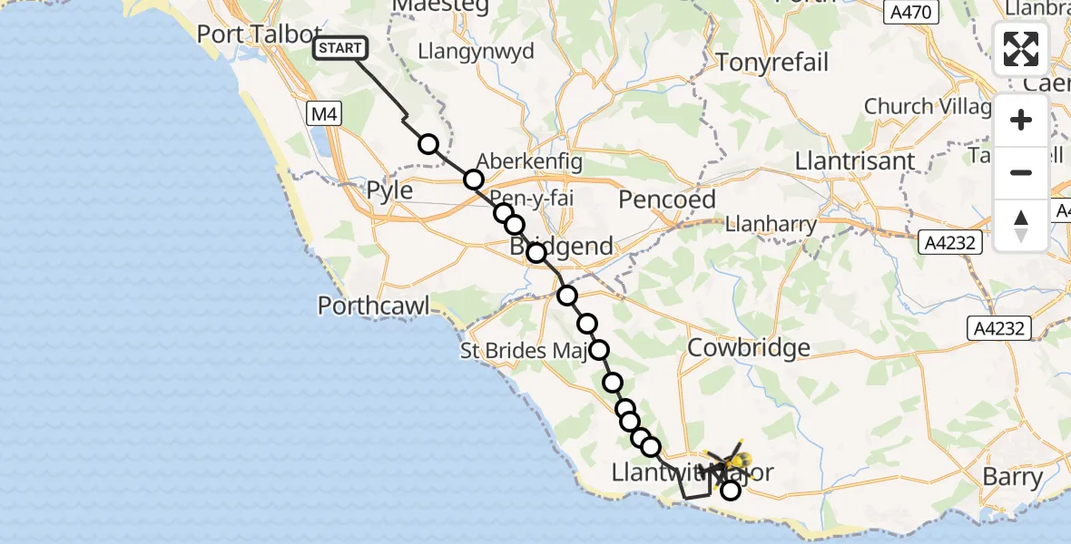
On Tuesday, 21 April 2026 at 23:04, a Police Helicopter departed from Margam to Boverton. It was the Police Helicopter with registration number G-NWOI. The flight lasted 10 minutes. During that period, the aircraft travelled 21 miles at an average speed of 125 miles per hour at a maximum altitude of 1425 feet.
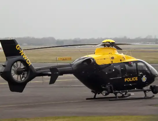
Helicopter: G-NWOI
The helicopter G-NWOI is used by the British police. The helicopter is deployed in pursuits, missing persons cases and other incidents where a helicopter provides added value.
Photo: James from Cheltenham
21 miles
1425 feet
125 mph
10 minutes
23:04
23:14

Route
Northern Access Road, Vale of Glamorgan23:14
Boverton, Vale of Glamorgan23:14
Llantwit Major, Vale of Glamorgan23:12
St Donats, Vale of Glamorgan23:11
Marcross, Vale of Glamorgan23:11
Llantwit Major, Vale of Glamorgan23:11
Wick, Vale of Glamorgan23:10
St. Brides Major, Vale of Glamorgan23:10
Ewenny, Vale of Glamorgan23:10
Corntown, Vale of Glamorgan23:09
Bridgend, Bridgend23:08
Bryntirion, Bridgend23:08
Pen-y-fai, Bridgend23:07
Cefn Cribwr, Bridgend23:07
Pen y Bryn, Neath Port Talbot23:06
Ffordd y Frenhines, Neath Port Talbot23:04
Live flights
Today
Police Helicopter to Monifieth03:27:33
Flights Boverton
Police Helicopter to MOD St Athan2 Aug 21:32
Police Helicopter to MOD St Athan1 Aug 22:05
Police Helicopter to MOD St Athan1 Aug 19:49
Police Helicopter to MOD St Athan1 Aug 00:04
Police Helicopter to Sigingstone, St Mary Church31 Jul 22:06
Police Helicopter to MOD St Athan31 Jul 21:42
Police Helicopter to Victoria, Pugsley Street31 Jul 15:36
Police Helicopter to MOD St Athan30 Jul 18:22
Police Helicopter to Dinas, Brithweunydd Road29 Jul 21:51
Flights Margam
Police Helicopter to MOD St Athan2 Jun 21:29
Air Ambulance Helicopter to Cardiff Heliport6 May 13:25
Police Helicopter to Margam, M425 Apr 01:16
Police Helicopter to Margam, Geifr Road15 Apr 11:50
Police Helicopter to MOD St Athan27 Mar 17:01
Police Helicopter to Margam, Margam Road5 Mar 21:22
Helicopter flights on your website?
You can easily display helicopter flights on your own website. Use the embed code.
