Police Helicopter to MOD St Athan
Friday, 27 March 2026 | 17:01 | From Margam
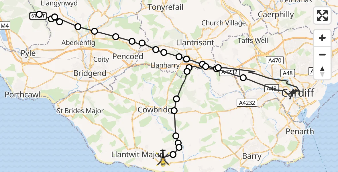
On Friday, 27 March 2026 at 17:01, a Police Helicopter departed from Margam to MOD St Athan. It was the Police Helicopter with registration number G-NWOI. The flight lasted 40 minutes. During that period, the aircraft travelled 53 miles at an average speed of 80 miles per hour at a maximum altitude of 1400 feet.
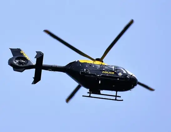
Helicopter: G-NWOI
The helicopter G-NWOI is used by the British police. The helicopter is deployed in pursuits, missing persons cases and other incidents where a helicopter provides added value.
Photo: Alec Wilson
53 miles
1400 feet
80 mph
41 minutes
17:01
17:41

Route
MOD St Athan, St Athan, Vale of Glamorgan17:41
MOD St Athan, St Athan, Vale of Glamorgan17:40
St Athan, Vale of Glamorgan17:40
St. Athan, Vale of Glamorgan17:39
Vale of Glamorgan, Vale of Glamorgan17:39
St Hilary, Vale of Glamorgan17:38
Aberthin, Vale of Glamorgan17:38
Ystradowen, Vale of Glamorgan17:37
Brynsadler, Rhondda Cynon Taf17:37
Miskin, Rhondda Cynon Taf17:36
M4, Vale of Glamorgan17:35
Cardiff, Cardiff17:07
M4, Vale of Glamorgan17:06
Miskin, Rhondda Cynon Taf17:06
Pontyclun, Rhondda Cynon Taf17:05
Brynsadler, Rhondda Cynon Taf17:05
Llanharan, Rhondda Cynon Taf17:05
Bryncae, Rhondda Cynon Taf17:04
Coychurch Higher, Bridgend17:04
Pencoed, Bridgend17:04
Heol-y-cyw, Bridgend17:03
Bryncethin, Bridgend17:03
Coytrahen, Bridgend17:02
Llangynwyd, Bridgend17:02
Llangynwyd Middle, Bridgend17:01
Llangynwyd, Bridgend17:01
Pen y Bryn, Neath Port Talbot17:01
Margam, Neath Port Talbot17:01
Live flights
Today
Flights Margam
Police Helicopter to MOD St Athan2 Jun 21:29
Air Ambulance Helicopter to Cardiff Heliport6 May 13:25
Police Helicopter to Margam, M425 Apr 01:16
Police Helicopter to Margam, Geifr Road15 Apr 11:50
Police Helicopter to MOD St Athan27 Mar 17:01
Police Helicopter to Margam, Margam Road5 Mar 21:22
Helicopter flights on your website?
You can easily display helicopter flights on your own website. Use the embed code.
