Air Ambulance Helicopter to Baginton, Siskin Parkway West
Friday, 20 February 2026 | 17:03 | From Wigston
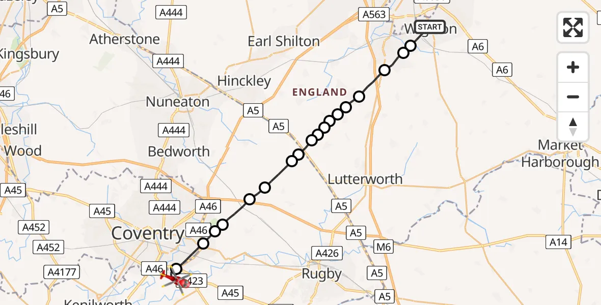
On Friday, 20 February 2026 at 17:03, a Air Ambulance Helicopter departed from Wigston to Baginton. It was the Air Ambulance Helicopter with registration number G-WNAS. The flight lasted 11 minutes. During that period, the aircraft travelled 22 miles at an average speed of 117 miles per hour at a maximum altitude of 1375 feet.
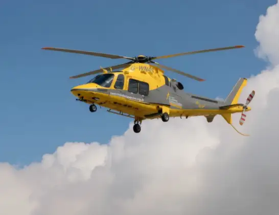
Helicopter: G-WNAS
The helicopter G-WNAS is used as an ambulance helicopter. The helicopter is equipped with a stretcher for transporting patients. The helicopter is often used to transport to hospitals.
Photo: Tony Melony
23 miles
1375 feet
117 mph
12 minutes
17:03
17:15

Route
Siskin Parkway West, Warwick17:15
Coventry Airport, Coventry, West Midlands17:13
Coventry, West Midlands17:12
Rugby17:11
Coventry17:11
Rugby17:10
Withybrook CP, Rugby17:10
Monks Kirby CP, Rugby17:09
Wibtoft CP, Rugby17:08
Claybrooke Parva, Harborough17:08
Claybrooke Magna, Harborough17:08
Frolesworth, Harborough17:07
Ashby Parva, Harborough17:07
Leire, Harborough17:07
Broughton Astley, Leicester17:06
Broughton Astley, Harborough17:06
Cosby17:05
Countesthorpe17:04
Blaby17:04
Two Steeples Square, Oadby and Wigston17:03
Live flights
Air Ambulance Helicopter on its way from Ashford14 Jul 23:46
Coastguard Helicopter on its way from North Sea14 Jul 23:44
Police Helicopter on its way from Inner Seas14 Jul 23:38
Today
Coastguard Helicopter to North Sea14 Jul 23:30
Police Helicopter to Inner Seas14 Jul 23:12
Air Ambulance Helicopter to Norwich Airport14 Jul 22:52
Police Helicopter to Manchester Barton Aerodrome14 Jul 22:50
Police Helicopter to Sewardstonebury, Bury Road14 Jul 22:44
Air Ambulance Helicopter to Cardiff Heliport14 Jul 22:43
Coastguard Helicopter to North Sea14 Jul 22:40
Flights Baginton
Air Ambulance Helicopter to Hunningham21 Mar 10:06
Air Ambulance Helicopter to Meriden, Main Road18 Mar 13:59
Air Ambulance Helicopter to Onley, Onley Road10 Mar 09:29
Air Ambulance Helicopter to Coventry Airport7 Mar 15:55
Flights Wigston
Air Ambulance Helicopter to Rugby, Fitzroy Close21 Apr 15:52
Air Ambulance Helicopter to Nottingham Heliport11 Apr 17:05
Air Ambulance Helicopter to Coventry Airport19 Mar 17:28
Helicopter flights on your website?
You can easily display helicopter flights on your own website. Use the embed code.
