Air Ambulance Helicopter to Wigston, Denmead Avenue
Thursday, 23 April 2026 | 8:26 | From Rushcliffe
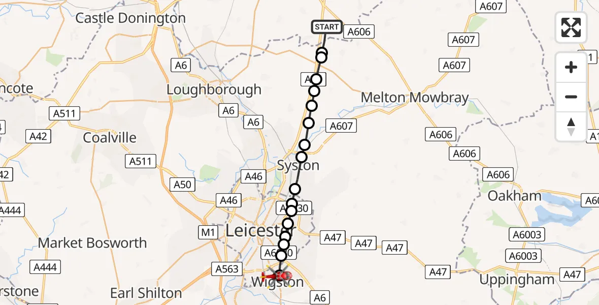
On Thursday, 23 April 2026 at 8:26, a Air Ambulance Helicopter departed from Rushcliffe to Wigston. It was the Air Ambulance Helicopter with registration number G-DRLA. The flight lasted 7 minutes. During that period, the aircraft travelled 18 miles at an average speed of 151 miles per hour at a maximum altitude of 650 feet.
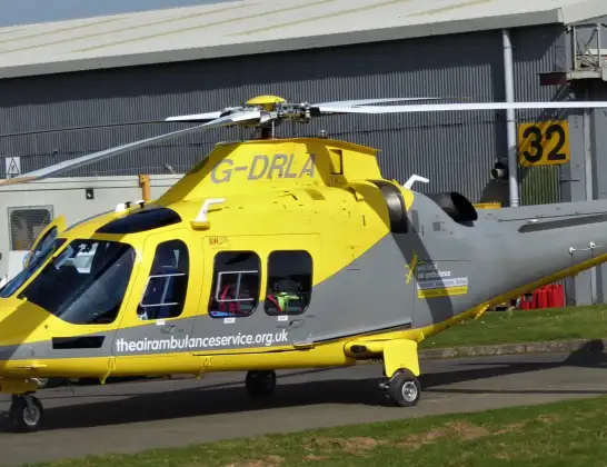
Helicopter: G-DRLA
The helicopter G-DRLA is used as an ambulance helicopter. The helicopter is equipped with a stretcher for transporting patients. The helicopter is often used to transport to hospitals.
Photo: Alec Wilson
19 miles
650 feet
151 mph
8 minutes
08:26
08:33

Route
Denmead Avenue, Leicestershire08:33
Wigston, Leicestershire08:32
Knighton, Leicester08:31
Stoneygate, Leicester08:31
Crown Hills, Leicester08:31
Humberstone, Leicester08:31
Hamilton, Leicester08:30
Rushey Mead, Leicester08:30
Thurmaston, Leicestershire08:30
Syston, Leicestershire08:29
East Goscote, Leicestershire08:29
Ratcliffe on the Wreake, Leicestershire08:28
Thrussington, Leicestershire08:28
Charnwood, Leicestershire08:28
Ragdale, Leicestershire08:27
Melton, Leicestershire08:27
Wymeswold, Leicestershire08:27
Folly Hall Lane, Nottinghamshire08:26
Live flights
Police Helicopter on its way from RAF Benson12 Jul 22:54
Police Helicopter on its way from Dundrod12 Jul 22:50
Police Helicopter on its way from East Ardsley12 Jul 22:44
Today
Air Ambulance Helicopter to Glasgow Airport12 Jul 22:48
Air Ambulance Helicopter to Norwich Airport12 Jul 22:27
Air Ambulance Helicopter to Northrepps Aerodrome12 Jul 22:23
Police Helicopter to Harborough, Sulby Road12 Jul 22:20
Air Ambulance Helicopter to Derriford Hospital12 Jul 22:12
Police Helicopter to Manchester Barton Aerodrome12 Jul 22:11
Air Ambulance Helicopter to Northrepps Aerodrome12 Jul 22:03
Flights Wigston
Air Ambulance Helicopter to Rugby, Fitzroy Close21 Apr 15:52
Air Ambulance Helicopter to Nottingham Heliport11 Apr 17:05
Air Ambulance Helicopter to Coventry Airport19 Mar 17:28
Flights Rushcliffe
Air Ambulance Helicopter to Rushcliffe, A461 Jul 18:42
Air Ambulance Helicopter to Ashwell, Oakham30 Jun 12:44
Air Ambulance Helicopter to Rushcliffe, A4629 Jun 11:54
Air Ambulance Helicopter to East Carlton, A42727 Jun 11:00
Helicopter flights on your website?
You can easily display helicopter flights on your own website. Use the embed code.
