Air Ambulance Helicopter to Baginton, Firefly Road
Saturday, 7 March 2026 | 11:19 | From Easenhall CP
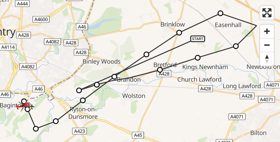
On Saturday, 7 March 2026 at 11:19, a Air Ambulance Helicopter departed from Easenhall CP to Baginton. It was the Air Ambulance Helicopter with registration number G-WNAS. The flight lasted 8 minutes. During that period, the aircraft travelled 21 miles at an average speed of 170 miles per hour at a maximum altitude of 775 feet.
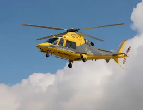
Helicopter: G-WNAS
The helicopter G-WNAS is used as an ambulance helicopter. The helicopter is equipped with a stretcher for transporting patients. The helicopter is often used to transport to hospitals.
Photo: Tony Melony
22 miles
775 feet
170 mph
8 minutes
11:19
11:27

Route
Firefly Road, Warwick11:27
Baginton, Warwick11:27
Coventry Airport, Coventry, West Midlands11:27
Baginton, Warwick11:26
Rugby, Rugby11:26
Ryton-on-Dunsmore, Rugby11:25
Brandon, Rugby11:25
Rugby, Rugby11:24
Brinklow CP, Rugby11:23
Easenhall CP, Rugby11:23
Harborough Magna CP, Rugby11:22
King's Newnham CP, Rugby11:21
Bretford, Rugby11:21
Brandon, Rugby11:20
Rugby, West Midlands11:20
Cathiron Lane, Rugby11:19
Live flights
Today
Flights Baginton
Air Ambulance Helicopter to Hunningham21 Mar 10:06
Air Ambulance Helicopter to Meriden, Main Road18 Mar 13:59
Air Ambulance Helicopter to Onley, Onley Road10 Mar 09:29
Air Ambulance Helicopter to Coventry Airport7 Mar 15:55
Helicopter flights on your website?
You can easily display helicopter flights on your own website. Use the embed code.
