Air Ambulance Helicopter to Wigston, Ingleby Road
Thursday, 19 March 2026 | 16:53 | From Coventry Airport
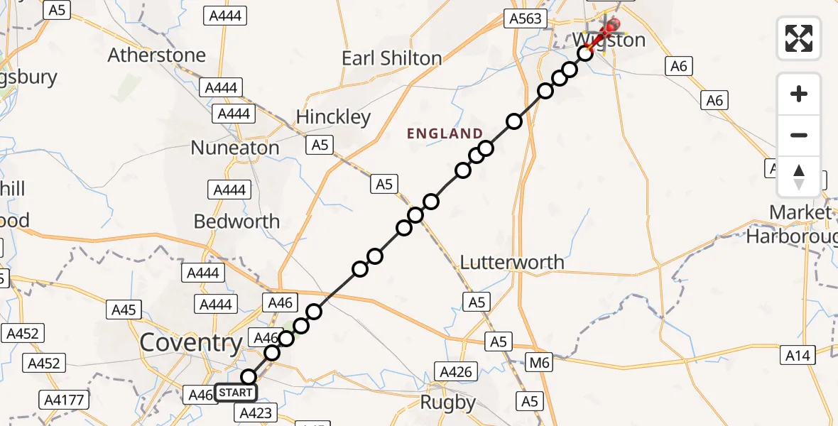
On Thursday, 19 March 2026 at 16:53, a Air Ambulance Helicopter departed from Coventry Airport to Wigston. It was the Air Ambulance Helicopter with registration number G-WNAS. The flight lasted 8 minutes. During that period, the aircraft travelled 21 miles at an average speed of 147 miles per hour at a maximum altitude of 650 feet.
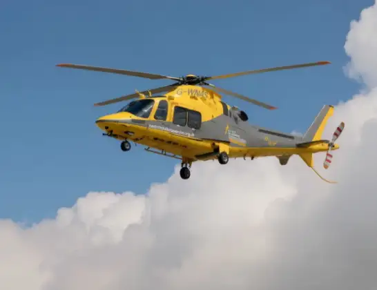
Helicopter: G-WNAS
The helicopter G-WNAS is used as an ambulance helicopter. The helicopter is equipped with a stretcher for transporting patients. The helicopter is often used to transport to hospitals.
Photo: Tony Melony
21 miles
650 feet
147 mph
9 minutes
16:53
17:01

Route
Ingleby Road, Oadby and Wigston17:01
Wigston, Oadby and Wigston17:01
Countesthorpe, Countesthorpe17:00
Countesthorpe, Leicester17:00
Whetstone, Whetstone17:00
Cosby, Cosby16:59
Broughton Astley, Harborough16:58
Leire, Harborough16:58
Frolesworth, Harborough16:58
Claybrooke Magna, Harborough16:57
Claybrooke Parva, Harborough16:57
Wibtoft CP, Rugby16:56
Monks Kirby CP, Rugby16:56
Withybrook CP, Rugby16:55
Rugby, Rugby16:54
Coventry, Coventry16:54
Rugby, Rugby16:54
Binley Woods CP, Rugby16:53
Coventry, Coventry16:53
London Road, Coventry16:53
Live flights
Today
Flights Wigston
Air Ambulance Helicopter to Rugby, Fitzroy Close21 Apr 15:52
Air Ambulance Helicopter to Nottingham Heliport11 Apr 17:05
Air Ambulance Helicopter to Coventry Airport19 Mar 17:28
Helicopter flights on your website?
You can easily display helicopter flights on your own website. Use the embed code.
