Air Ambulance Helicopter to Baginton, Siskin Parkway West
Friday, 16 January 2026 | 16:25 | From Melton
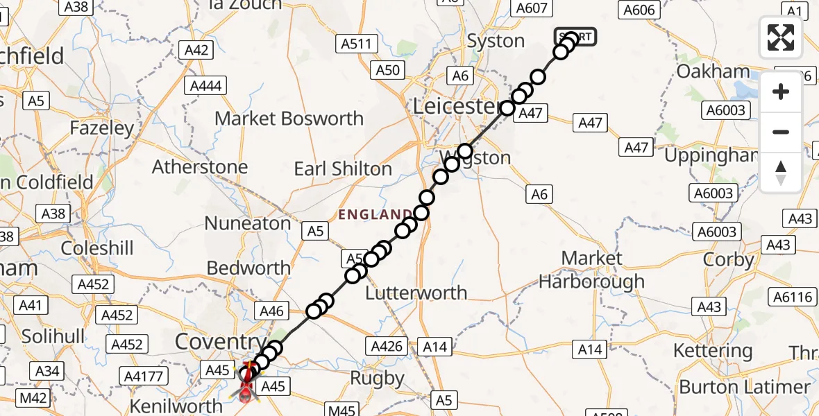
On Friday, 16 January 2026 at 16:25, a Air Ambulance Helicopter departed from Melton to Baginton. It was the Air Ambulance Helicopter with registration number G-WNAS. The flight lasted 15 minutes. During that period, the aircraft travelled 33 miles at an average speed of 130 miles per hour at a maximum altitude of 1550 feet.
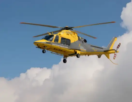
Helicopter: G-WNAS
The helicopter G-WNAS is used as an ambulance helicopter. The helicopter is equipped with a stretcher for transporting patients. The helicopter is often used to transport to hospitals.
Photo: Tony Melony
33 miles
1550 feet
130 mph
16 minutes
16:25
16:40

Route
Siskin Parkway West, Warwick16:40
Coventry Airport, Coventry, West Midlands16:39
Coventry, West Midlands16:39
Rugby16:39
Binley Woods CP, Rugby16:39
Coventry, West Midlands16:38
Binley Woods CP, Rugby16:38
Rugby16:36
Monks Kirby CP, Rugby16:36
Withybrook CP, Rugby16:35
Monks Kirby CP, Rugby16:34
Wibtoft CP, Rugby16:34
Claybrooke Parva, Harborough16:34
Ullesthorpe, Harborough16:33
Ashby Parva, Harborough16:33
Leire, Harborough16:32
Broughton Astley, Harborough16:32
Blaby16:32
Cosby16:31
Whetstone16:30
Blaby16:30
Wigston, Oadby and Wigston16:29
Leicester16:28
Scraptoft, Harborough16:27
Keyham, Harborough16:27
Beeby, Charnwood16:26
South Croxton, Charnwood16:25
Barsby, Melton16:25
Ashby Folville, Melton16:25
Melton, 16:25
Live flights
Today
Police Helicopter to Epping Forest, Green Lane26 Feb 23:43
Flights Baginton
Air Ambulance Helicopter to Kingshurst, A45216 Feb 11:58
Air Ambulance Helicopter to Rushden, Quorn Road29 Jan 14:06
Flights Melton
Helicopter flights on your website?
You can easily display helicopter flights on your own website. Use the embed code.
