Air Ambulance Helicopter to Far Cotton, Towcester Road
Saturday, 31 January 2026 | 13:49 | From Baginton
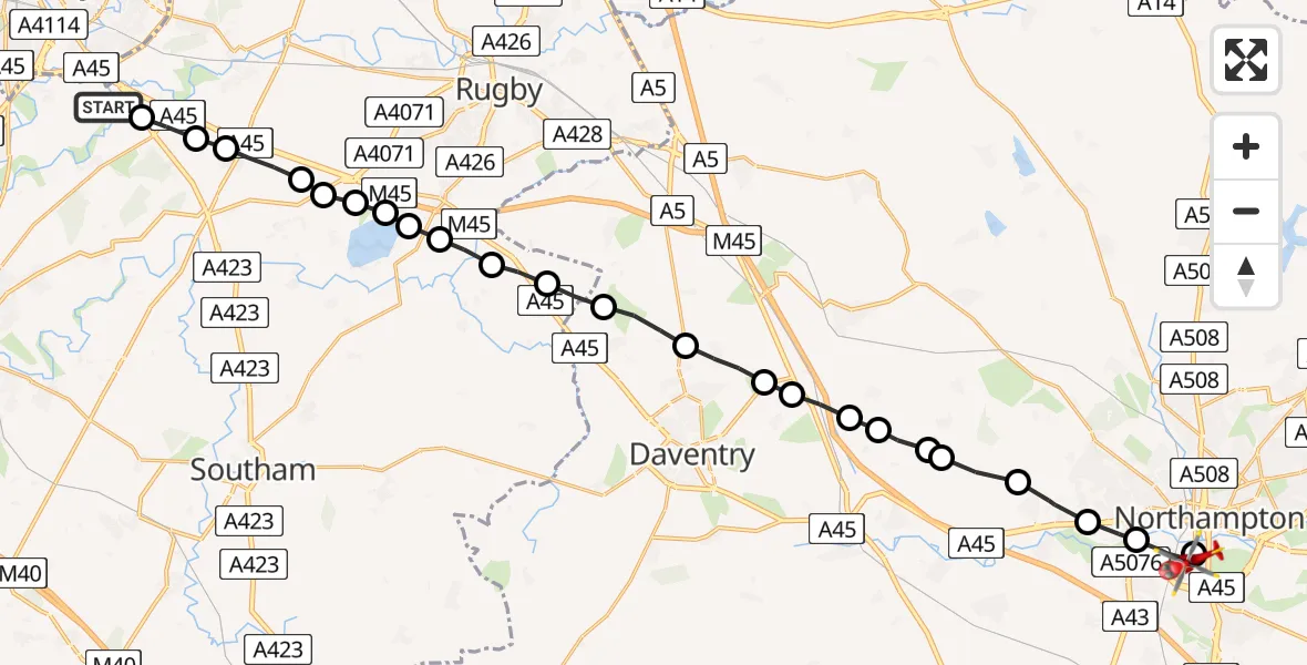
On Saturday, 31 January 2026 at 13:49, a Air Ambulance Helicopter departed from Baginton to Far Cotton. It was the Air Ambulance Helicopter with registration number G-WNAS. The flight lasted 11 minutes. During that period, the aircraft travelled 26 miles at an average speed of 141 miles per hour at a maximum altitude of 1925 feet.
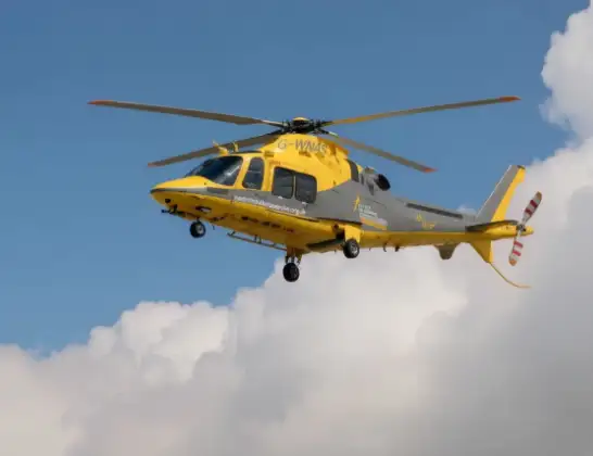
Helicopter: G-WNAS
The helicopter G-WNAS is used as an ambulance helicopter. The helicopter is equipped with a stretcher for transporting patients. The helicopter is often used to transport to hospitals.
Photo: Tony Melony
26 miles
1925 feet
141 mph
12 minutes
13:49
14:00

Route
Towcester Road, 14:00
Far Cotton13:59
Northampton13:58
Upton13:58
Harpole13:57
Brington13:56
Flore13:56
Little Brington13:56
Flore13:55
Long Buckby Wharf13:55
Daventry13:55
Welton13:54
Braunston13:53
Willoughby CP, Rugby13:53
Grandborough CP, Rugby13:52
Dunchurch, Rugby13:52
Draycote Water13:51
Thurlaston CP, Rugby13:51
Draycote, Rugby13:51
Bourton on Dunsmore, Rugby13:51
Rugby13:50
Stretton on Dunsmore CP, Rugby13:50
Rugby13:49
Ryton-on-Dunsmore, Rugby13:49
Siskin Parkway East, Warwick13:49
Live flights
Coastguard Helicopter on its way from North Sea14 Jul 23:44
Today
Air Ambulance Helicopter to Redhill Aerodrome14 Jul 23:46
Police Helicopter to Johnstone, Gordon Square14 Jul 23:38
Coastguard Helicopter to North Sea14 Jul 23:30
Police Helicopter to Inner Seas14 Jul 23:12
Air Ambulance Helicopter to Norwich Airport14 Jul 22:52
Police Helicopter to Manchester Barton Aerodrome14 Jul 22:50
Police Helicopter to Sewardstonebury, Bury Road14 Jul 22:44
Flights Baginton
Air Ambulance Helicopter to Hunningham21 Mar 10:06
Air Ambulance Helicopter to Meriden, Main Road18 Mar 13:59
Air Ambulance Helicopter to Onley, Onley Road10 Mar 09:29
Air Ambulance Helicopter to Coventry Airport7 Mar 15:55
Helicopter flights on your website?
You can easily display helicopter flights on your own website. Use the embed code.
