Air Ambulance Helicopter to Church Stowe, Watling Street
Wednesday, 25 February 2026 | 7:59 | From Baginton
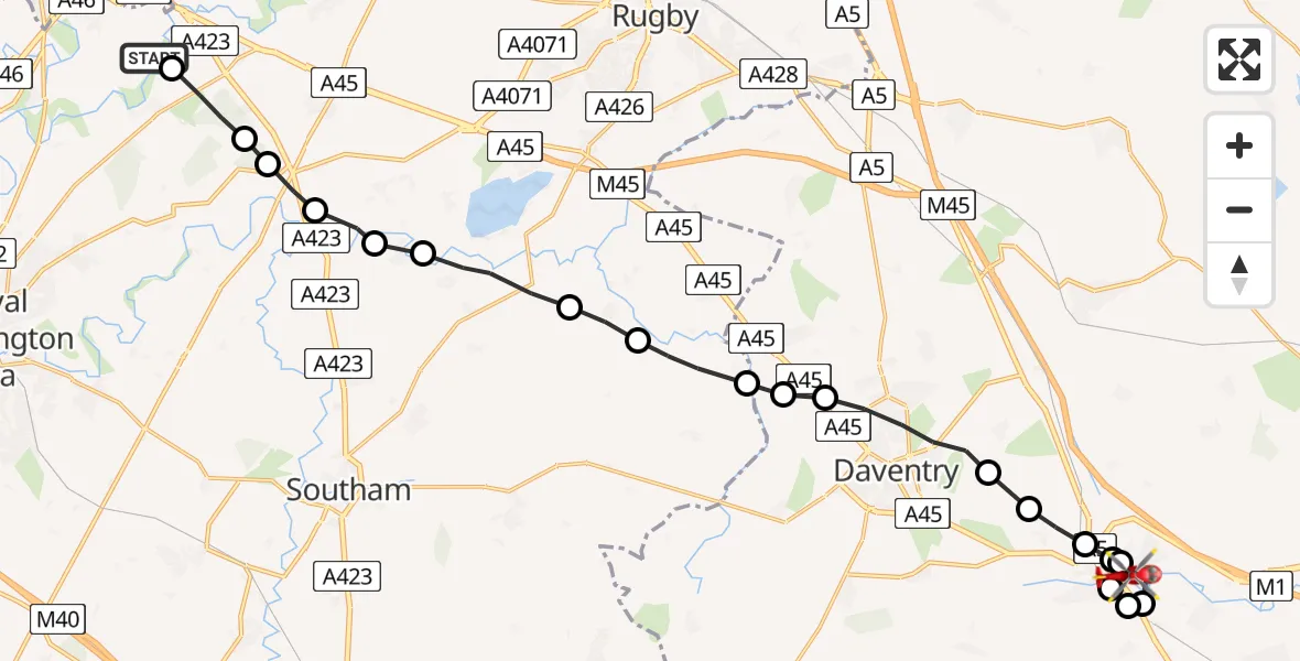
On Wednesday, 25 February 2026 at 7:59, a Air Ambulance Helicopter departed from Baginton to Church Stowe. It was the Air Ambulance Helicopter with registration number G-WNAS. The flight lasted 9 minutes. During that period, the aircraft travelled 22 miles at an average speed of 144 miles per hour at a maximum altitude of 1050 feet.
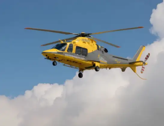
Helicopter: G-WNAS
The helicopter G-WNAS is used as an ambulance helicopter. The helicopter is equipped with a stretcher for transporting patients. The helicopter is often used to transport to hospitals.
Photo: Tony Melony
22 miles
1050 feet
144 mph
10 minutes
07:59
08:08

Route
Watling Street, 08:08
Flore08:08
Weedon Bec08:08
Church Stowe08:07
Nether Heyford08:07
Flore08:06
Weedon Bec08:06
Dodford08:06
Norton08:05
Daventry08:04
Braunston08:04
Rugby08:04
Sawbridge, Rugby08:03
Grandborough CP, Rugby08:03
Leamington Hastings CP, Rugby08:02
Birdingbury CP, Rugby08:01
Frankton CP, Rugby08:01
Princethorpe CP, Rugby08:00
Stretton on Dunsmore CP, Rugby08:00
Rugby07:59
Baginton, Warwick07:59
Live flights
Coastguard Helicopter on its way from North Sea14 Jul 23:44
Today
Air Ambulance Helicopter to Redhill Aerodrome14 Jul 23:46
Police Helicopter to Johnstone, Gordon Square14 Jul 23:38
Coastguard Helicopter to North Sea14 Jul 23:30
Police Helicopter to Inner Seas14 Jul 23:12
Air Ambulance Helicopter to Norwich Airport14 Jul 22:52
Police Helicopter to Manchester Barton Aerodrome14 Jul 22:50
Police Helicopter to Sewardstonebury, Bury Road14 Jul 22:44
Flights Baginton
Air Ambulance Helicopter to Hunningham21 Mar 10:06
Air Ambulance Helicopter to Meriden, Main Road18 Mar 13:59
Air Ambulance Helicopter to Onley, Onley Road10 Mar 09:29
Air Ambulance Helicopter to Coventry Airport7 Mar 15:55
Helicopter flights on your website?
You can easily display helicopter flights on your own website. Use the embed code.
