Police Helicopter to West Kinfauns, A90
Saturday, 2 May 2026 | 17:03 | From Penicuik
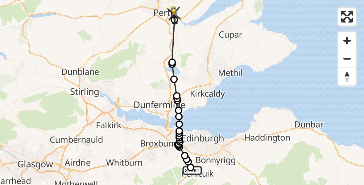
On Saturday, 2 May 2026 at 17:03, a Police Helicopter departed from Penicuik to West Kinfauns. It was the Police Helicopter with registration number G-BZRS. The flight lasted 18 minutes. During that period, the aircraft travelled 40 miles at an average speed of 130 miles per hour at a maximum altitude of 2525 feet.

Helicopter: G-BZRS
The helicopter G-BZRS is used by the British police. The helicopter is deployed in pursuits, missing persons cases and other incidents where a helicopter provides added value.
Photo: NMOS332
40 miles
2525 feet
130 mph
19 minutes
17:03
17:21

Route
A90, Perth and Kinross17:21
Perth, Perth and Kinross17:20
Kinross, Perth and Kinross17:16
Loch Leven17:16
Ballingry, Fife17:14
Cowdenbeath, Fife17:12
Crossgates, Fife17:12
Cowdenbeath, Fife17:12
Aberdour, Fife17:11
Dalgety Bay, Fife17:10
North Sea17:09
Home Farm Cottages, City of Edinburgh17:09
Burnshot, City of Edinburgh17:08
City of Edinburgh, City of Edinburgh17:08
West Craigs, City of Edinburgh17:08
Edinburgh Airport, Edinburgh17:08
West Craigs, City of Edinburgh17:07
City of Edinburgh, City of Edinburgh17:07
Roddinglaw, City of Edinburgh17:07
City of Edinburgh, City of Edinburgh17:06
Roddinglaw, City of Edinburgh17:06
Gogarbank, City of Edinburgh17:06
Currie, City of Edinburgh17:04
Balerno, City of Edinburgh17:04
Midlothian, Midlothian17:04
Kirkton, Midlothian17:03
A702, Midlothian17:03
Live flights
Today
Flights Penicuik
Police Helicopter to Penicuik, Carlops Road31 May 20:46
Police Helicopter to West Kinfauns, A902 May 17:03
Police Helicopter to Penicuik, Old Kirk Road16 Apr 14:32
Helicopter flights on your website?
You can easily display helicopter flights on your own website. Use the embed code.
