Police Helicopter to Penicuik, Scottish Borders
Saturday, 2 May 2026 | 15:40 | From Burntisland
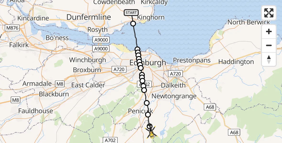
On Saturday, 2 May 2026 at 15:40, a Police Helicopter departed from Burntisland to Penicuik. It was the Police Helicopter with registration number G-BZRS. The flight lasted 10 minutes. During that period, the aircraft travelled 22 miles at an average speed of 138 miles per hour at a maximum altitude of 2525 feet.
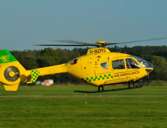
Helicopter: G-BZRS
The helicopter G-BZRS is used by the British police. The helicopter is deployed in pursuits, missing persons cases and other incidents where a helicopter provides added value.
Photo: NMOS332
22 miles
2525 feet
138 mph
10 minutes
15:40
15:49

Route
Scottish Borders, Scottish Borders15:49
Midlothian, Midlothian15:49
Howgate, Midlothian15:48
Auchendinny, Midlothian15:47
Bush, Midlothian15:46
Swanston, City of Edinburgh15:46
Fairmilehead, City of Edinburgh15:45
Greenbank, City of Edinburgh15:45
Morningside, City of Edinburgh15:45
Merchiston, City of Edinburgh15:44
Dean Village, City of Edinburgh15:44
Comely Bank, City of Edinburgh15:44
Fettes Police HQ15:43
Comely Bank, City of Edinburgh15:43
Granton and District, City of Edinburgh15:43
City of Edinburgh15:43
North Sea15:41
B9157, Fife15:40
Live flights
Today
Flights Penicuik
Police Helicopter to Penicuik, Carlops Road31 May 20:46
Police Helicopter to West Kinfauns, A902 May 17:03
Police Helicopter to Penicuik, Old Kirk Road16 Apr 14:32
Flights Burntisland
Police Helicopter to Burntisland, B91572 Jun 22:07
Helicopter flights on your website?
You can easily display helicopter flights on your own website. Use the embed code.
