Police Helicopter to Tranwell, The Pastures
Thursday, 30 April 2026 | 23:54 | From Kenton
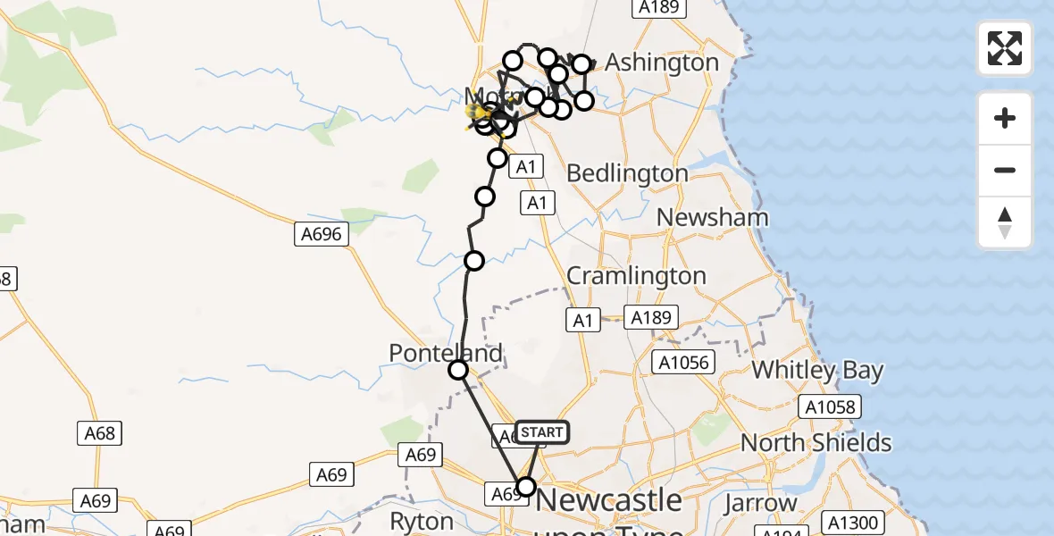
On Thursday, 30 April 2026 at 23:54, a Police Helicopter departed from Kenton to Tranwell. It was the Police Helicopter with registration number G-POLA. The flight lasted 21 minutes. During that period, the aircraft travelled 42 miles at an average speed of 121 miles per hour at a maximum altitude of 1775 feet.
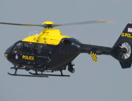
Helicopter: G-POLA
The helicopter G-POLA is used by the British police. The helicopter is deployed in pursuits, missing persons cases and other incidents where a helicopter provides added value.
Photo: ozz13x
43 miles
1775 feet
121 mph
22 minutes
23:54
00:15

Route
The Pastures, Northumberland00:15
Morpeth, Northumberland00:15
Tranwell, Northumberland00:14
Morpeth, Northumberland00:12
Tranwell, Northumberland00:12
Morpeth, Northumberland00:11
Tranwell, Northumberland00:11
Morpeth, Northumberland00:09
Hepscott, Northumberland00:09
Pegswood, Northumberland00:08
Hepscott, Northumberland00:08
Ashington, Northumberland00:06
Pegswood, Northumberland00:04
Hepscott, Northumberland00:04
Pegswood, Northumberland00:03
Morpeth, Northumberland23:58
Glororum, Northumberland23:58
St Mary's Park, Northumberland23:57
Stannington, Northumberland23:57
Ponteland, Northumberland23:55
Ullswater Way, Tyne and Wear - Newcastle upon Tyne23:55
Kenton, Tyne and Wear - Newcastle upon Tyne23:54
Live flights
Today
Flights Tranwell
Police Helicopter to Tranwell, The Pastures30 Apr 23:54
Air Ambulance Helicopter to Stannington Station23 Feb 09:46
Flights Kenton
Police Helicopter to Tranwell, The Pastures30 Apr 23:54
Police Helicopter to Wallsend, Tyne Approach10 Apr 13:30
Police Helicopter to Teignbridge, Buckland Road27 Jan 20:10
Helicopter flights on your website?
You can easily display helicopter flights on your own website. Use the embed code.
