Air Ambulance Helicopter to Stannington Station
Monday, 23 February 2026 | 9:46 | From Tranwell
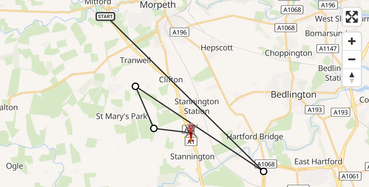
On Monday, 23 February 2026 at 9:46, a Air Ambulance Helicopter departed from Tranwell to Stannington Station. It was the Air Ambulance Helicopter with registration number G-SCAA. The flight lasted 3 minutes. During that period, the aircraft travelled 12 miles at an average speed of 258 miles per hour at a maximum altitude of 3750 feet.
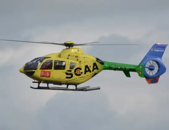
Helicopter: G-SCAA
The helicopter G-SCAA is used as a air ambulance helicopter. The main purpose of this aircraft is to transport a Mobile Medical Team to an incident as quickly as possible, enabling the trauma doctor to provide immediate first aid on site. The aircraft is flying this flight as Air Ambulance Helicopter.
Photo: Jonathan Payne
13 miles
3750 feet
258 mph
3 minutes
09:46
09:49

Route
Stannington Station, North East09:49
Stannington, North East09:48
Glororum, North East09:48
Cramlington, North East09:47
A1, North East09:46
Live flights
Today
Police Helicopter to MOD St Athan15 Jul 23:53
Police Helicopter to East Ardsley, Stoney Lane15 Jul 23:36
Flights Tranwell
Police Helicopter to Tranwell, The Pastures30 Apr 23:54
Air Ambulance Helicopter to Stannington Station23 Feb 09:46
Helicopter flights on your website?
You can easily display helicopter flights on your own website. Use the embed code.
