Air Ambulance Aircraft to Milngavie, Craigmaddie Road
Monday, 27 April 2026 | 10:13 | From Argyll and Bute
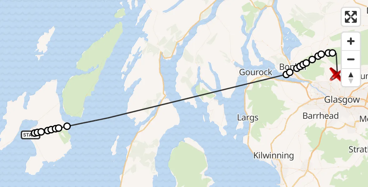
On Monday, 27 April 2026 at 10:13, a Air Ambulance Aircraft departed from Argyll and Bute to Milngavie. It was the Air Ambulance Aircraft with registration number G-SASD. The flight lasted 23 minutes. During that period, the aircraft travelled 86 miles at an average speed of 225 miles per hour at a maximum altitude of 7000 feet.
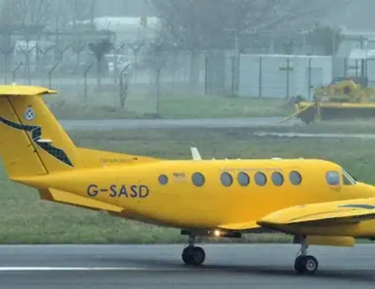
Helicopter: G-SASD
The aircraft G-SASD is used as an air ambulance aircraft. The main purpose of this aircraft is to transport a Mobile Medical Team to an incident as quickly as possible, enabling the trauma doctor to provide immediate first aid on site. The aircraft is flying this flight as Air Ambulance Aircraft.
Photo: Albert Bridge
87 miles
7000 feet
225 mph
24 minutes
10:13
10:36

Route
Craigmaddie Road, East Dunbartonshire10:36
Stirling, Stirling10:33
Balfron, Stirling10:33
Killearn, Stirling10:32
Carbeth, Stirling10:32
Croftamie, Stirling10:31
West Dunbartonshire, West Dunbartonshire10:31
Bonhill, West Dunbartonshire10:31
Milton, West Dunbartonshire10:30
Bonhill, West Dunbartonshire10:30
Dumbarton, West Dunbartonshire10:30
Ardoch, Argyll and Bute10:29
Inner Seas10:16
Argyll and Bute, Argyll and Bute10:15
Allalladh, Argyll and Bute10:15
Argyll and Bute, Argyll and Bute10:15
Kilennan, Argyll and Bute10:15
Argyll and Bute, Argyll and Bute10:14
Bowmore, Argyll and Bute10:14
Cruach, Argyll and Bute10:13
Argyll and Bute, Argyll and Bute10:13
Live flights
Today
Police Helicopter to Fife, B91404:13:14
Flights Milngavie
Police Helicopter to Milngavie, Baldernock Lynn24 May 11:44
Police Helicopter to Milngavie, Craigmaddie Road20 May 14:19
Police Helicopter to Milngavie1 May 12:19
Police Helicopter to Milngavie, Craigmaddie Road18 Apr 16:51
Police Helicopter to Glasgow, Foxbar Drive14 Apr 12:51
Helicopter flights on your website?
You can easily display helicopter flights on your own website. Use the embed code.
