Police Helicopter to Milngavie, Craigmaddie Road
Saturday, 18 April 2026 | 16:51 | From Glasgow
On Saturday, 18 April 2026 at 16:51, a Police Helicopter departed from Glasgow to Milngavie. It was the Police Helicopter with registration number G-POLS. The flight lasted 20 minutes. During that period, the aircraft travelled 37 miles at an average speed of 112 miles per hour at a maximum altitude of 3300 feet.
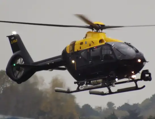
Helicopter: G-POLS
The helicopter G-POLS is used by the British police. The helicopter is deployed in pursuits, missing persons cases and other incidents where a helicopter provides added value.
Photo: James from Cheltenham, Gloucestershire
38 miles
3300 feet
112 mph
21 minutes
16:51
17:11

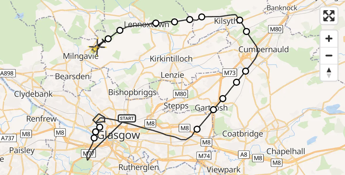
Route
Craigmaddie Road, East Dunbartonshire17:11
Milngavie, East Dunbartonshire17:11
Clachan of Campsie, East Dunbartonshire17:10
Lennoxtown, East Dunbartonshire17:09
Milton of Campsie, East Dunbartonshire17:08
Kirkintilloch, East Dunbartonshire17:07
Queenzieburn, North Lanarkshire17:07
Kilsyth, North Lanarkshire17:05
Dullatur, North Lanarkshire17:05
Cumbernauld, North Lanarkshire17:03
Mollinsburn, North Lanarkshire17:02
Glenboig, North Lanarkshire17:02
Gartcosh, North Lanarkshire17:01
Gartloch, Glasgow City17:00
Glasgow, Glasgow City16:55
Glasgow City Heliport, Glasgow16:54
Glasgow Seaplane Terminal, Glasgow16:54
Springburn Road, Glasgow City16:51
Live flights
Flights Milngavie
Police Helicopter to Milngavie, Hazel Avenue20 Jul 21:20
Police Helicopter to Renfrew, King's Inch Road13 Jul 14:36
Police Helicopter to Milngavie, Baldernock Lynn24 May 11:44
Police Helicopter to Milngavie, Craigmaddie Road20 May 14:19
Police Helicopter to Milngavie1 May 12:19
Police Helicopter to Milngavie, Craigmaddie Road18 Apr 16:51
Police Helicopter to Glasgow, Foxbar Drive14 Apr 12:51
Flights Glasgow
Police Helicopter to Glasgow, Water Row20 Jul 15:38
Police Helicopter to Glasgow, Taransay Street19 Jul 18:14
Police Helicopter to Glasgow, Wanlock Street18 Jul 15:28
Police Helicopter to Glasgow, Kilmany Gardens18 Jul 15:16
Police Helicopter to Glasgow, Fergus Drive18 Jul 03:23
Police Helicopter to Glasgow, Renfrew Road17 Jul 23:34
Helicopter flights on your website?
You can easily display helicopter flights on your own website. Use the embed code.
