Police Helicopter to Newcastle International Airport
Sunday, 26 April 2026 | 16:23 | From Fence Houses
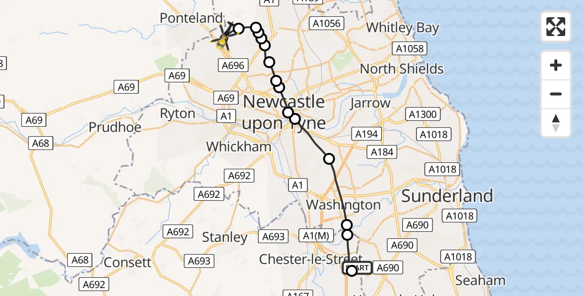
On Sunday, 26 April 2026 at 16:23, a Police Helicopter departed from Fence Houses to Newcastle International Airport. It was the Police Helicopter with registration number G-POLA. The flight lasted 9 minutes. During that period, the aircraft travelled 18 miles at an average speed of 113 miles per hour at a maximum altitude of 1200 feet.
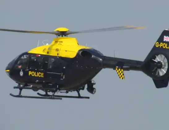
Helicopter: G-POLA
The helicopter G-POLA is used by the British police. The helicopter is deployed in pursuits, missing persons cases and other incidents where a helicopter provides added value.
Photo: ozz13x
18 miles
1200 feet
113 mph
10 minutes
16:23
16:32

Route
Newcastle International Airport, Newcastle upon Tyne, Tyne and Wear16:32
Newcastle International Airport, Newcastle upon Tyne, Tyne and Wear16:31
Dinnington, Newcastle upon Tyne16:30
Newcastle upon Tyne, Newcastle upon Tyne16:30
Hazlerigg Village, Newcastle upon Tyne16:30
Middle Brunton, Newcastle upon Tyne16:29
Coxlodge, Newcastle upon Tyne16:29
Gosforth, Newcastle upon Tyne16:28
Cowgate, Newcastle upon Tyne16:28
Shieldfield, Newcastle upon Tyne16:28
Shieldfield, Gateshead16:27
Gateshead, Gateshead16:26
Washington, Sunderland16:24
Washington, County Durham16:24
Bournmoor, County Durham16:23
Henry Terrace, County Durham16:23
Live flights
Today
Air Ambulance Helicopter to Croy19:46:09
Helicopter flights on your website?
You can easily display helicopter flights on your own website. Use the embed code.
