Air Ambulance Helicopter to Croy
Sunday, 26 April 2026 | 19:46 | From Highland
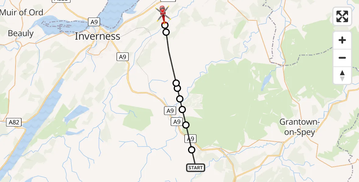
On Sunday, 26 April 2026 at 19:46, a Air Ambulance Helicopter departed from Highland to Croy. It was the Air Ambulance Helicopter with registration number G-GSAS. The flight lasted 7 minutes. During that period, the aircraft travelled 18 miles at an average speed of 148 miles per hour at a maximum altitude of 2975 feet.
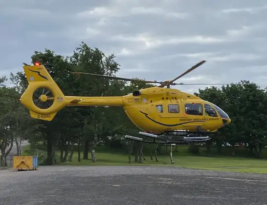
Helicopter: G-GSAS
The helicopter G-GSAS is used as a air ambulance helicopter. The main purpose of this aircraft is to transport a Mobile Medical Team to an incident as quickly as possible, enabling the trauma doctor to provide immediate first aid on site. The aircraft is flying this flight as Air Ambulance Helicopter.
Photo: Scanbus
18 miles
2975 feet
148 mph
8 minutes
19:46
19:53

Route
Croy, Highland19:53
Croy, Highland19:52
Newlands of Culloden, Highland19:52
Highland, Highland19:50
Shenachie, Highland19:49
Ruthven, Highland19:49
Corry Bruoch Beg, Highland19:48
Tomatin, Highland19:48
Slochd Summit, Highland19:46
Highland, Highland19:46
Live flights
Today
Flights Croy
Air Ambulance Helicopter to Moray26 Jul 00:21
Air Ambulance Helicopter to Croy19 Jul 20:14
Air Ambulance Helicopter to RAF Lossiemouth9 Jun 14:17
Air Ambulance Helicopter to Croy26 Apr 19:46
Air Ambulance Helicopter to Croy, A9628 Mar 19:13
Air Ambulance Helicopter to Croy4 Mar 23:58
Air Ambulance Helicopter to Croy4 Mar 23:58
Air Ambulance Helicopter to Croy4 Mar 23:58
Air Ambulance Helicopter to Croy4 Mar 23:58
Flights Highland
Coastguard Helicopter to Highland31 Jul 18:06
Coastguard Helicopter to Highland31 Jul 15:21
Coastguard Helicopter to Highland30 Jul 17:14
Coastguard Helicopter to Highland, A8230 Jul 14:41
Coastguard Helicopter to Inverness Airport29 Jul 14:41
Air Ambulance Helicopter to Highland29 Jul 14:15
Air Ambulance Helicopter to Highland29 Jul 14:01
Coastguard Helicopter to Highland, A929 Jul 13:29
Helicopter flights on your website?
You can easily display helicopter flights on your own website. Use the embed code.
