Police Helicopter to East Kilbride, Greenhills Road
Sunday, 26 April 2026 | 20:33 | From Thorntonhall
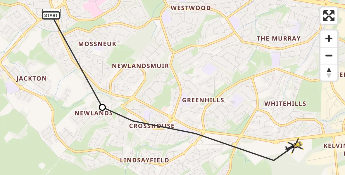
On Sunday, 26 April 2026 at 20:33, a Police Helicopter departed from Thorntonhall to East Kilbride. It was the Police Helicopter with registration number G-POLS. The flight lasted 1 minutes. During that period, the aircraft travelled 3 miles at an average speed of 127 miles per hour at a maximum altitude of 1250 feet.
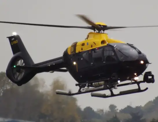
Helicopter: G-POLS
The helicopter G-POLS is used by the British police. The helicopter is deployed in pursuits, missing persons cases and other incidents where a helicopter provides added value.
Photo: James from Cheltenham, Gloucestershire
3 miles
1250 feet
127 mph
2 minutes
20:33
20:35

Route
Greenhills Road, South Lanarkshire20:35
East Kilbride, South Lanarkshire20:34
Eaglesham Road, South Lanarkshire20:33
Live flights
Today
Coastguard Helicopter to Inverness Airport23 Jun 23:35
Air Ambulance Helicopter to Cardiff Heliport23 Jun 22:58
Police Helicopter to North Weald Airfield23 Jun 22:39
Air Ambulance Helicopter to Farnborough Airport23 Jun 22:35
Coastguard Helicopter to Humberside Airport23 Jun 22:32
Air Ambulance Helicopter to Norwich Airport23 Jun 22:16
Air Ambulance Helicopter to RAF Northolt23 Jun 22:04
Flights Thorntonhall
Police Helicopter to Glasgow, Partickhill Avenue23 Mar 20:34
Police Helicopter to Glasgow, Burghead Place4 Feb 17:02
Helicopter flights on your website?
You can easily display helicopter flights on your own website. Use the embed code.
