Air Ambulance Helicopter to Dorchester, Poundbury Road
Wednesday, 15 April 2026 | 13:05 | From Easton
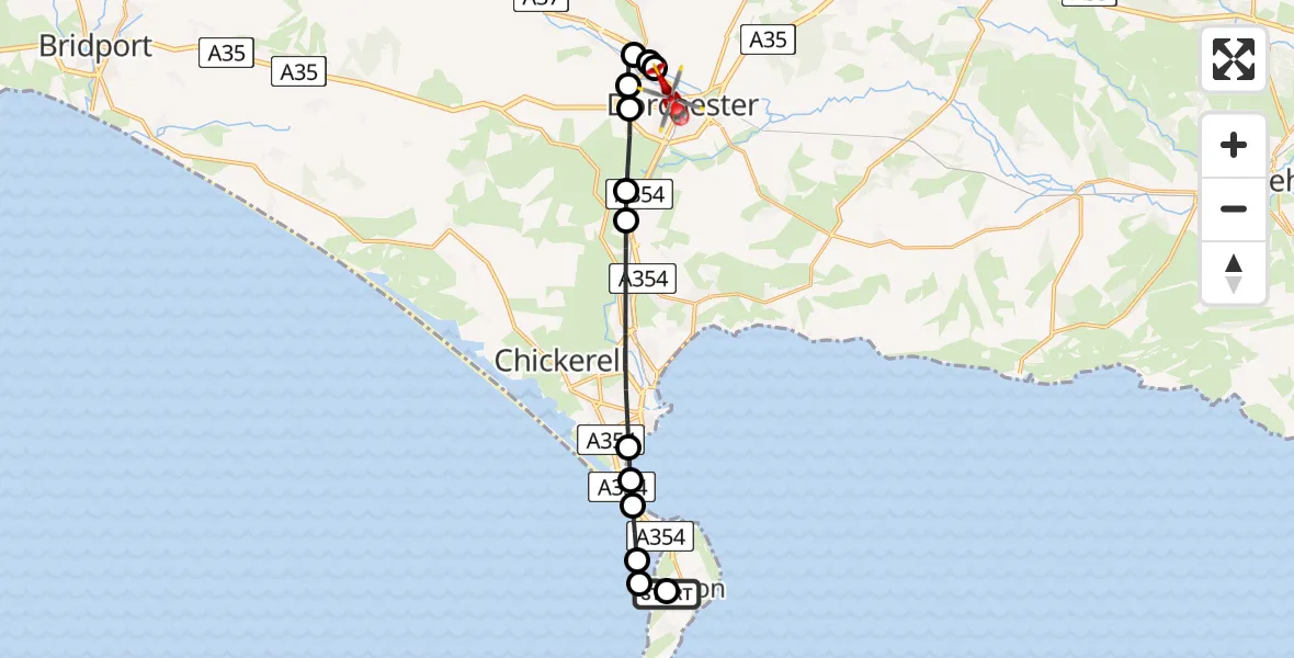
On Wednesday, 15 April 2026 at 13:05, a Air Ambulance Helicopter departed from Easton to Dorchester. It was the Air Ambulance Helicopter with registration number G-DSAA. The flight lasted 8 minutes. During that period, the aircraft travelled 15 miles at an average speed of 109 miles per hour at a maximum altitude of 1050 feet.
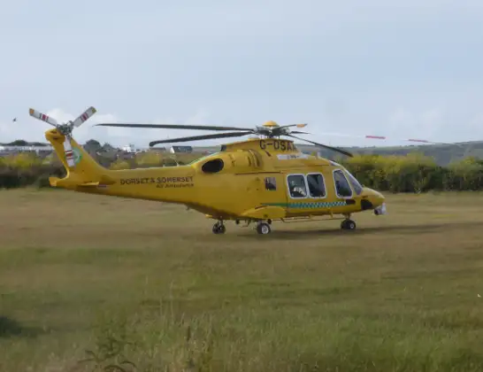
Helicopter: G-DSAA
The helicopter G-DSAA is used as a air ambulance helicopter. The main purpose of this aircraft is to transport a Mobile Medical Team to an incident as quickly as possible, enabling the trauma doctor to provide immediate first aid on site. The aircraft is flying this flight as Air Ambulance Helicopter.
Photo: Andrew Bone
16 miles
1050 feet
109 mph
9 minutes
13:05
13:14

Route
Poundbury Road, Dorset13:14
Dorchester, Dorset13:12
Charminster, Dorset13:12
Bradford Peverell, Dorset13:12
Charminster, Dorset13:11
Dorchester, Dorset13:11
Winterborne Monkton, Dorset13:10
Upwey, Dorset13:10
Weymouth, Dorset13:08
Wyke Regis, Dorset13:08
Chiswell, Dorset13:07
English Channel13:07
Weston13:07
Weston, Dorset13:06
Wide Street, Dorset13:05
Live flights
Today
Flights Dorchester
Air Ambulance Helicopter to Henstridge Airfield23 May 18:41
Air Ambulance Helicopter to Henstridge Airfield24 Apr 14:15
Air Ambulance Helicopter to Henstridge Airfield15 Apr 14:13
Flights Easton
Police Helicopter to Ewelme, Brook Street2 Apr 23:05
Helicopter flights on your website?
You can easily display helicopter flights on your own website. Use the embed code.
