Air Ambulance Helicopter to Dorchester, Poundbury Road
Tuesday, 31 March 2026 | 14:25 | From Durlston
On Tuesday, 31 March 2026 at 14:25, a Air Ambulance Helicopter departed from Durlston to Dorchester. It was the Air Ambulance Helicopter with registration number G-DSAA. The flight lasted 20 minutes. During that period, the aircraft travelled 25 miles at an average speed of 75 miles per hour at a maximum altitude of 400 feet.
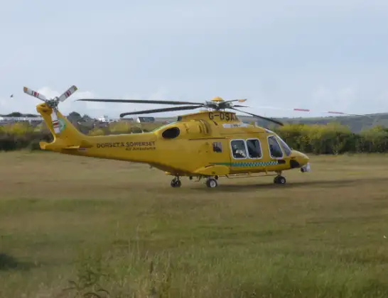
Helicopter: G-DSAA
The helicopter G-DSAA is used as a air ambulance helicopter. The main purpose of this aircraft is to transport a Mobile Medical Team to an incident as quickly as possible, enabling the trauma doctor to provide immediate first aid on site. The aircraft is flying this flight as Air Ambulance Helicopter.
Photo: Andrew Bone
26 miles
400 feet
75 mph
21 minutes
14:25
14:45

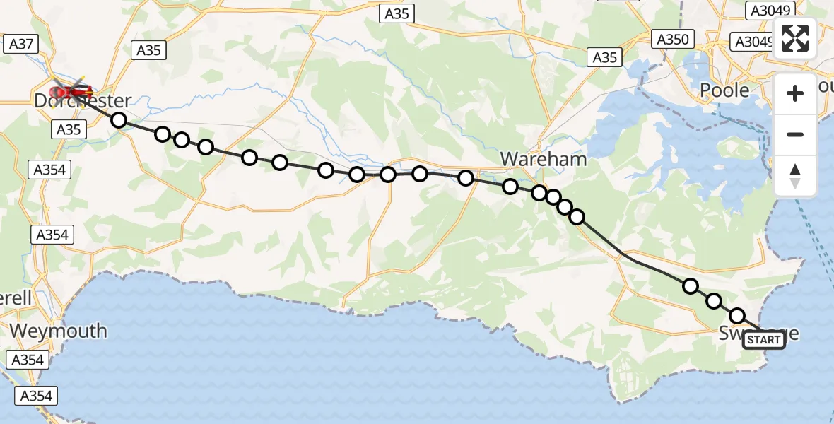
Route
Poundbury Road, Dorset14:45
Dorchester, Dorset14:41
West Stafford, Dorset14:40
Lower Lewell Farm, Dorset14:40
RAF Warmwell, Dorchester, Dorset14:39
Crossways, Dorset14:39
Chaldon Herring, Dorset14:38
East Knighton, Dorset14:37
Wool, Dorset14:37
Wareham, Dorset14:36
Wool, Dorset14:36
East Stoke, Dorset14:35
Wareham, Dorset14:34
Stoborough, Dorset14:34
Wareham, Dorset14:34
Stoborough Green, Dorset14:33
Furzebrook, Dorset14:33
Corfe Castle, Dorset14:31
Langton Matravers, Dorset14:30
Swanage, Dorset14:30
Durlston, Dorset14:25
Live flights
Today
Flights Dorchester
Air Ambulance Helicopter to Henstridge Airfield23 May 18:41
Air Ambulance Helicopter to Henstridge Airfield24 Apr 14:15
Air Ambulance Helicopter to Henstridge Airfield15 Apr 14:13
Flights Durlston
Police Helicopter to English Channel14 Jun 18:50
Police Helicopter to Durlston, Swanage Pier14 Jun 18:29
Air Ambulance Helicopter to Durlston, Broad Road31 Mar 12:53
Coastguard Helicopter to Solent Airport29 Mar 16:02
Coastguard Helicopter to Durlston29 Mar 15:45
Coastguard Helicopter to Durlston29 Mar 14:57
Air Ambulance Helicopter to Durlston28 Mar 07:58
Helicopter flights on your website?
You can easily display helicopter flights on your own website. Use the embed code.
