Police Helicopter to Ewelme, Brook Street
Thursday, 2 April 2026 | 23:05 | From Easton

On Thursday, 2 April 2026 at 23:05, a Police Helicopter departed from Easton to Ewelme. It was the Police Helicopter with registration number G-POLF. The flight lasted 7 minutes. During that period, the aircraft travelled 19 miles at an average speed of 158 miles per hour at a maximum altitude of 1300 feet.
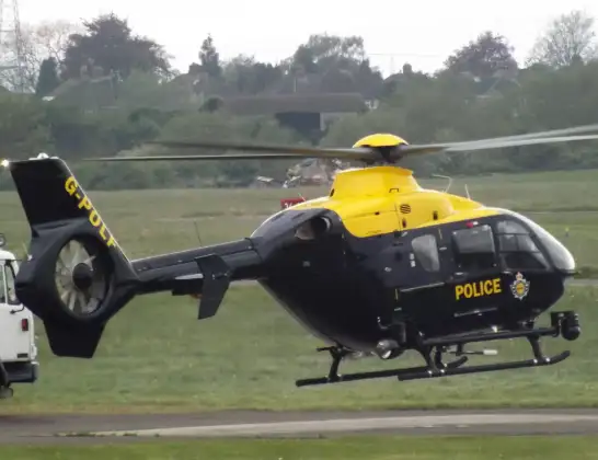
Helicopter: G-POLF
The helicopter G-POLF is used by the British police. The helicopter is deployed in pursuits, missing persons cases and other incidents where a helicopter provides added value.
Photo: James
20 miles
1300 feet
158 mph
8 minutes
23:05
23:12

Route
Brook Street, Oxfordshire23:12
Ewelme, Oxfordshire23:12
Berrick Salome, Oxfordshire23:12
Benson, Oxfordshire23:11
Shillingford, Oxfordshire23:11
Brightwell-cum-Sotwell, Oxfordshire23:11
Cholsey, Oxfordshire23:10
South Moreton, Oxfordshire23:10
Aston Upthorpe, Oxfordshire23:09
Blewbury, Oxfordshire23:08
Blewbury, West Berkshire23:08
East Ilsley, West Berkshire23:07
Peasemore, West Berkshire23:06
Leckhampstead, West Berkshire23:06
Firs Farm Airstrip, Newbury, Berkshire23:06
Welford, West Berkshire23:05
Boxford, West Berkshire23:05
M4, West Berkshire23:05
Today
Coastguard Helicopter to Solent Airport5 Jul 23:21
Air Ambulance Aircraft to RAF Lossiemouth5 Jul 23:17
Police Helicopter to Glasgow, Beech Avenue5 Jul 23:05
Police Aircraft to East Midlands Airport5 Jul 22:38
Air Ambulance Helicopter to North Sea5 Jul 22:14
Police Helicopter to Solihull, Centro Way5 Jul 22:09
Police Helicopter to Hawarden Airport5 Jul 21:47
Flights Ewelme
Police Helicopter to Ewelme5 Jul 20:13
Police Helicopter to Benson, The Sands30 Jun 15:07
Police Helicopter to Berrick Salome, Benson28 Jun 23:45
Police Helicopter to Benson, The Sands28 Jun 21:41
Police Helicopter to Benson, The Sands27 Jun 13:43
Police Helicopter to RAF Benson26 Jun 20:01
Flights Easton
Police Helicopter to Ewelme, Brook Street2 Apr 23:05
Helicopter flights on your website?
You can easily display helicopter flights on your own website. Use the embed code.
