Air Ambulance Helicopter to Edenhall, The Avenue
Sunday, 5 April 2026 | 19:48 | From Westward
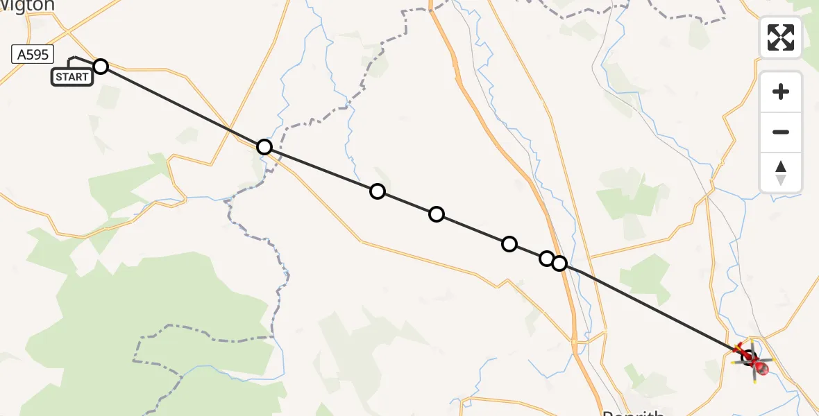
On Sunday, 5 April 2026 at 19:48, a Air Ambulance Helicopter departed from Westward to Edenhall. It was the Air Ambulance Helicopter with registration number G-NHAE. The flight lasted 8 minutes. During that period, the aircraft travelled 21 miles at an average speed of 148 miles per hour at a maximum altitude of 1550 feet.
Helicopter: G-NHAE
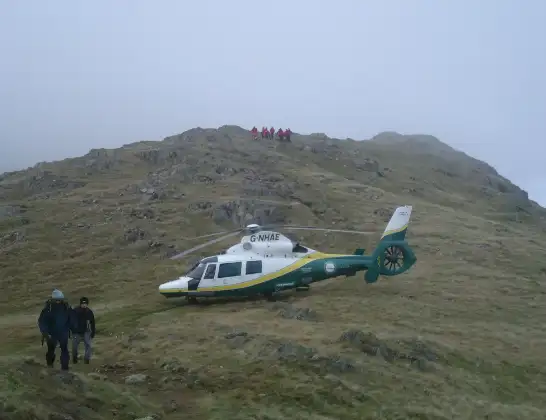
The helicopter G-NHAE is used as a air ambulance helicopter. The main purpose of this aircraft is to transport a Mobile Medical Team to an incident as quickly as possible, enabling the trauma doctor to provide immediate first aid on site. The aircraft is flying this flight as Air Ambulance Helicopter.
Photo: Michael Earnshaw
21 miles
1550 feet
148 mph
9 minutes
19:48
19:56

Route
The Avenue, Westmorland and Furness19:56
Edenhall, Westmorland and Furness19:56
Plumpton, Westmorland and Furness19:54
Calthwaite, Westmorland and Furness19:54
Skelton, Westmorland and Furness19:54
Low Braithwaite, Westmorland and Furness19:53
Skelton, Westmorland and Furness19:53
Sebergham, Cumberland19:51
Rosley, Cumberland19:50
Westward, Cumberland19:48
Live flights
Today
Air Ambulance Helicopter to Highland5 Apr 23:53
Police Helicopter to Saltney Ferry, B51295 Apr 23:50
Police Helicopter to Bournemouth Airport5 Apr 23:23
Air Ambulance Helicopter to Argyll and Bute5 Apr 23:21
Police Helicopter to Hawarden Airport5 Apr 22:59
Police Helicopter to Redhill Aerodrome5 Apr 22:53
Air Ambulance Helicopter to Logierait, C4525 Apr 22:50
Flights Edenhall
Air Ambulance Helicopter to Buttermere5 Apr 15:31
Air Ambulance Helicopter to Mungrisdale, A664 Apr 15:07
Air Ambulance Helicopter to Bampton Grange1 Apr 14:26
Air Ambulance Helicopter to Cumberland31 Mar 14:36
Air Ambulance Helicopter to Mungrisdale, A59430 Mar 18:33
Air Ambulance Helicopter to Edenhall4 Mar 12:14
Air Ambulance Helicopter to Culgaith, B64123 Mar 09:39
Flights Westward
Air Ambulance Helicopter to Westward5 Apr 19:15
Air Ambulance Helicopter to Westward5 Apr 19:04
Air Ambulance Helicopter to Westward14 Mar 15:33
Helicopter flights on your website?
You can easily display helicopter flights on your own website. Use the embed code.
