Air Ambulance Helicopter to Mungrisdale, A594
Monday, 30 March 2026 | 18:33 | From Edenhall
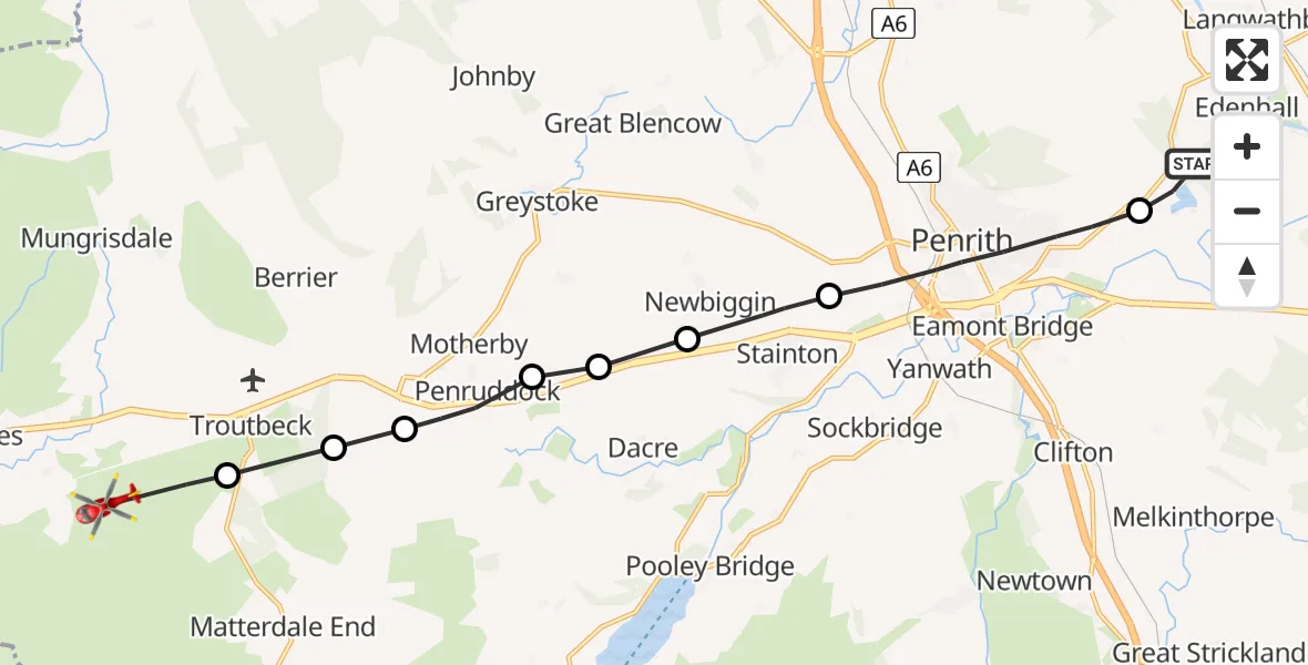
On Monday, 30 March 2026 at 18:33, a Air Ambulance Helicopter departed from Edenhall to Mungrisdale. It was the Air Ambulance Helicopter with registration number G-NHAE. The flight lasted 6 minutes. During that period, the aircraft travelled 13 miles at an average speed of 130 miles per hour at a maximum altitude of 2150 feet.
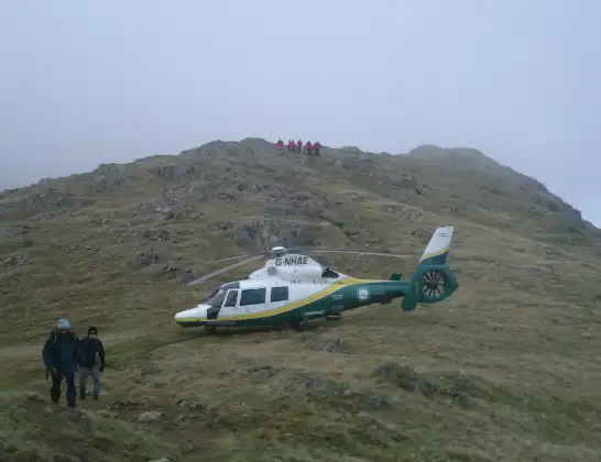
Helicopter: G-NHAE
The helicopter G-NHAE is used as a air ambulance helicopter. The main purpose of this aircraft is to transport a Mobile Medical Team to an incident as quickly as possible, enabling the trauma doctor to provide immediate first aid on site. The aircraft is flying this flight as Air Ambulance Helicopter.
Photo: Michael Earnshaw
13 miles
2150 feet
130 mph
6 minutes
18:33
18:39

Route
A594, Westmorland and Furness18:39
Troutbeck, Westmorland and Furness18:38
Cocklakes Hill, Westmorland and Furness18:38
Motherby, Westmorland and Furness18:37
Penruddock, Westmorland and Furness18:37
Dacre, Westmorland and Furness18:36
Newbiggin, Westmorland and Furness18:36
Stainton, Westmorland and Furness18:35
Penrith, Westmorland and Furness18:33
Edenhall, Westmorland and Furness18:33
Live flights
Today
Flights Mungrisdale
Air Ambulance Helicopter to Mungrisdale, A664 Apr 15:07
Air Ambulance Helicopter to Mungrisdale, A59430 Mar 18:33
Flights Edenhall
Air Ambulance Helicopter to Skirwith1 Jul 09:53
Air Ambulance Helicopter to Kirkby Ireleth29 Jun 09:21
Air Ambulance Helicopter to Edenhall, B641228 Jun 15:45
Air Ambulance Helicopter to Edenhall, B641228 Jun 11:52
Air Ambulance Helicopter to Edenhall27 Jun 19:32
Air Ambulance Helicopter to Edenhall27 Jun 17:40
Helicopter flights on your website?
You can easily display helicopter flights on your own website. Use the embed code.
