Coastguard Helicopter to Glasgow Prestwick Airport
Monday, 9 March 2026 | 11:50 | From Taynuilt
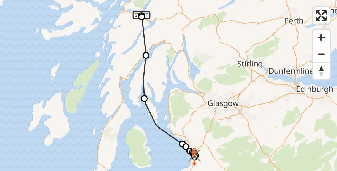
On Monday, 9 March 2026 at 11:50, a Coastguard Helicopter departed from Taynuilt to Glasgow Prestwick Airport. It was the Coastguard Helicopter with registration number G-MCGI. The flight lasted 33 minutes. During that period, the aircraft travelled 75 miles at an average speed of 136 miles per hour at a maximum altitude of 1550 feet.

Helicopter: G-MCGI
The helicopter G-MCGI is used by the British Coastguard. The helicopter is deployed in search and rescue operations at sea, rescue operations involving ships or drilling platforms, patrols to prevent smuggling or piracy, environmental monitoring and disaster relief support.
Photo: CG Rescue G-MCGI MG 0869.jpg by Ronnie Robertson Licensed under CC BY-SA 2.0 Source: https://commons.wikimedia.org/wiki/File:CG_Rescue_G-MCGI_MG_0869.jpg
75 miles
1550 feet
136 mph
34 minutes
11:50
12:23

Route
Glasgow Prestwick Airport, Prestwick, South Ayrshire12:23
Glasgow Prestwick Airport, Prestwick, South Ayrshire12:22
Prestwick, Prestwick12:21
Hansel Village, Hansel Village12:21
Symington, Symington12:21
Monkton, Monkton12:20
Loans, Loans12:20
Troon, Troon12:19
Irvine, Irvine12:18
Inner Seas12:07
Pennymore, Pennymore11:59
Bridge of Awe, Bridge of Awe11:50
Inverawe, Inverawe11:50
A85, Taynuilt11:50
Live flights
Today
Police Helicopter to Manchester Barton Aerodrome13 Jul 23:56
Police Helicopter to Bournemouth Airport13 Jul 23:55
Air Ambulance Helicopter to Cardiff Heliport13 Jul 23:38
Police Helicopter to Harborough, Sulby Road13 Jul 23:36
Police Helicopter to Birmingham Airport13 Jul 23:21
Flights Taynuilt
Coastguard Helicopter to Taynuilt, A8510 Jun 15:14
Coastguard Helicopter to Argyll and Bute16 Apr 16:38
Coastguard Helicopter to Bonawe23 Mar 13:26
Air Ambulance Helicopter to Taynuilt, B8454 Mar 15:23
Coastguard Helicopter to Inveresragan, A856 Feb 20:53
Coastguard Helicopter to Taynuilt6 Feb 16:48
Helicopter flights on your website?
You can easily display helicopter flights on your own website. Use the embed code.
