Air Ambulance Helicopter to Dorchester, Poundbury Road
Saturday, 14 February 2026 | 19:16 | From Beaminster
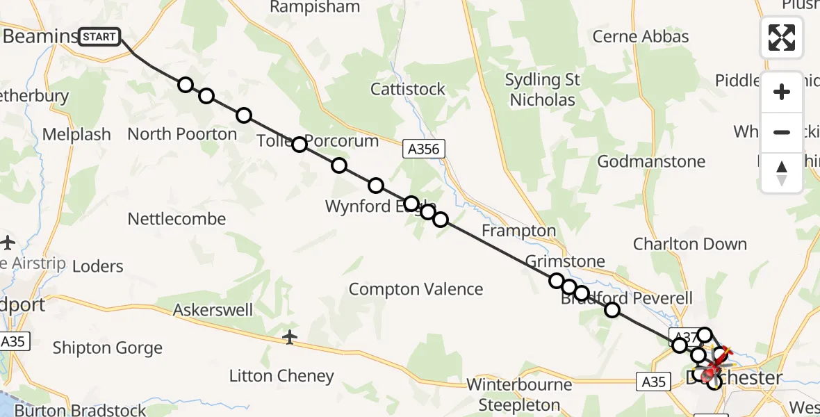
On Saturday, 14 February 2026 at 19:16, a Air Ambulance Helicopter departed from Beaminster to Dorchester. It was the Air Ambulance Helicopter with registration number G-DSAA. The flight lasted 12 minutes. During that period, the aircraft travelled 16 miles at an average speed of 78 miles per hour at a maximum altitude of 1125 feet.
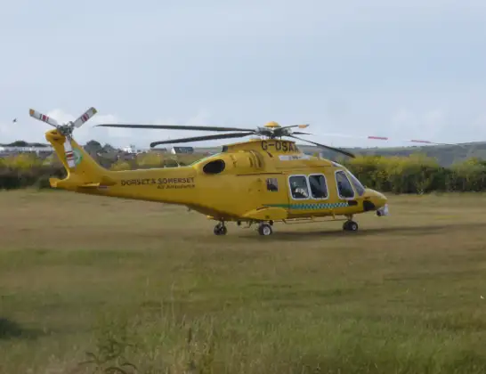
Helicopter: G-DSAA
The helicopter G-DSAA is used as a air ambulance helicopter. The main purpose of this aircraft is to transport a Mobile Medical Team to an incident as quickly as possible, enabling the trauma doctor to provide immediate first aid on site. The aircraft is flying this flight as Air Ambulance Helicopter.
Photo: Andrew Bone
16 miles
1125 feet
78 mph
13 minutes
19:16
19:28

Route
Poundbury Road, 19:28
Dorchester19:27
Charminster19:26
Dorchester19:26
Dorchester Hospital, Dorchester19:26
Dorchester19:25
Charminster19:24
Bradford Peverell19:23
Stratton19:23
Winterbourne Steepleton19:23
Grimstone19:22
Frampton19:20
Frome Vauchurch19:20
Maiden Newton19:20
Wynford Eagle19:19
Toller Fratrum19:19
Toller Porcorum19:18
Powerstock19:18
North Poorton19:17
Hooke19:17
Langdon Lane, 19:16
Live flights
Today
Flights Dorchester
Air Ambulance Helicopter to Henstridge Airfield23 May 18:41
Air Ambulance Helicopter to Henstridge Airfield24 Apr 14:15
Air Ambulance Helicopter to Henstridge Airfield15 Apr 14:13
Flights Beaminster
Police Helicopter to Beaminster, A306628 Apr 15:31
Helicopter flights on your website?
You can easily display helicopter flights on your own website. Use the embed code.
