Air Ambulance Helicopter to Exeter International Airport, Exeter International Airport
Sunday, 8 February 2026 | 12:02 | From Teignbridge
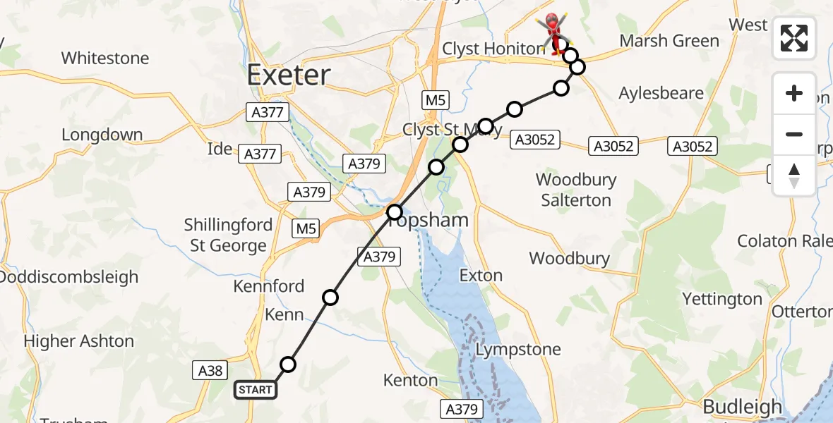
On Sunday, 8 February 2026 at 12:02, a Air Ambulance Helicopter departed from Teignbridge to Exeter International Airport. It was the Air Ambulance Helicopter with registration number G-DAAS. The flight lasted 6 minutes. During that period, the aircraft travelled 10 miles at an average speed of 99 miles per hour at a maximum altitude of 1425 feet.

Helicopter: G-DAAS
The helicopter G-DAAS is used as a air ambulance helicopter. The main purpose of this aircraft is to transport a Mobile Medical Team to an incident as quickly as possible, enabling the trauma doctor to provide immediate first aid on site. The aircraft is flying this flight as Air Ambulance Helicopter.
Photo: James
10 miles
1425 feet
99 mph
6 minutes
12:02
12:08

Route
Exeter International Airport, Exeter, Devon12:08
Exeter International Airport, Exeter, Devon12:07
Clyst Honiton, East Devon12:07
Aylesbeare, East Devon12:07
East Devon, Devon and Torbay12:07
Clyst Honiton, East Devon12:06
Clyst St Mary, Exeter12:06
Clyst St Mary, East Devon12:06
Clyst St. George, Topsham12:06
Topsham, Exeter12:05
Exminster, Teignbridge12:04
Kenn, Teignbridge12:03
Teignbridge, Devon and Torbay12:02
Live flights
Today
Police Helicopter to Epping Forest, Green Lane26 Feb 23:43
Flights Teignbridge
Police Helicopter to Teignbridge, Greenway Lane21 Feb 15:02
Police Helicopter to Teignbridge, Buckland Road27 Jan 20:10
Police Helicopter to Rockbeare, Rockbeare27 Jan 16:49
Helicopter flights on your website?
You can easily display helicopter flights on your own website. Use the embed code.
