Air Ambulance Helicopter to Teignbridge
Sunday, 8 February 2026 | 10:57 | From Exeter International Airport
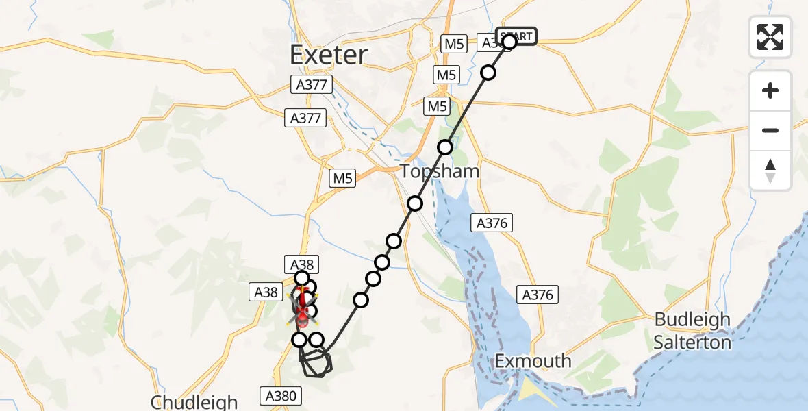
On Sunday, 8 February 2026 at 10:57, a Air Ambulance Helicopter departed from Exeter International Airport to Teignbridge. It was the Air Ambulance Helicopter with registration number G-DAAS. The flight lasted 12 minutes. During that period, the aircraft travelled 19 miles at an average speed of 98 miles per hour at a maximum altitude of 1950 feet.

Helicopter: G-DAAS
The helicopter G-DAAS is used as a air ambulance helicopter. The main purpose of this aircraft is to transport a Mobile Medical Team to an incident as quickly as possible, enabling the trauma doctor to provide immediate first aid on site. The aircraft is flying this flight as Air Ambulance Helicopter.
Photo: Alan Wilson
20 miles
1950 feet
98 mph
12 minutes
10:57
11:09

Route
Teignbridge, Devon and Torbay11:09
Teignbridge, Devon and Torbay11:09
Teignbridge, Devon and Torbay11:08
Kenn, Teignbridge11:07
Teignbridge, Devon and Torbay11:07
Kenn, Teignbridge11:06
Teignbridge, Devon and Torbay11:03
Ideford, Teignbridge11:02
Teignbridge, Devon and Torbay11:01
Kenn, Teignbridge11:01
Kenton, Teignbridge11:01
Teignbridge, Devon and Torbay11:00
Exminster, Teignbridge11:00
Topsham, Exeter10:59
Clyst St Mary, East Devon10:58
Clyst Honiton, East Devon10:57
Exeter International Airport, Exeter, Devon10:57
Live flights
Police Helicopter on its way from RAF Benson12 Jul 22:54
Police Helicopter on its way from Dundrod12 Jul 22:50
Police Helicopter on its way from East Ardsley12 Jul 22:44
Today
Air Ambulance Helicopter to Glasgow Airport12 Jul 22:48
Air Ambulance Helicopter to Norwich Airport12 Jul 22:27
Air Ambulance Helicopter to Northrepps Aerodrome12 Jul 22:23
Police Helicopter to Harborough, Sulby Road12 Jul 22:20
Air Ambulance Helicopter to Derriford Hospital12 Jul 22:12
Police Helicopter to Manchester Barton Aerodrome12 Jul 22:11
Air Ambulance Helicopter to Northrepps Aerodrome12 Jul 22:03
Flights Teignbridge
Police Helicopter to East Devon, A3029 Apr 20:28
Helicopter flights on your website?
You can easily display helicopter flights on your own website. Use the embed code.
