Air Ambulance Helicopter to Dorchester, Poundbury Road
Saturday, 31 January 2026 | 11:53 | From Nottington
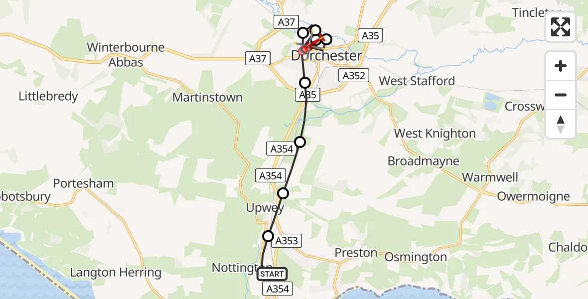
On Saturday, 31 January 2026 at 11:53, a Air Ambulance Helicopter departed from Nottington to Dorchester. It was the Air Ambulance Helicopter with registration number G-DSAA. The flight lasted 8 minutes. During that period, the aircraft travelled 8 miles at an average speed of 63 miles per hour at a maximum altitude of 2025 feet.
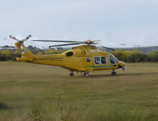
Helicopter: G-DSAA
The helicopter G-DSAA is used as a air ambulance helicopter. The main purpose of this aircraft is to transport a Mobile Medical Team to an incident as quickly as possible, enabling the trauma doctor to provide immediate first aid on site. The aircraft is flying this flight as Air Ambulance Helicopter.
Photo: Andrew Bone
9 miles
2025 feet
63 mph
8 minutes
11:53
12:01

Route
Poundbury Road, 12:01
Dorchester12:00
Charminster11:59
Dorchester11:59
Charminster11:58
Dorchester11:58
Winterborne Monkton11:57
Upwey11:57
Upwey, Weymouth11:56
Weymouth Relief Road, Weymouth11:55
Nottington, Weymouth11:53
Live flights
Today
Flights Dorchester
Air Ambulance Helicopter to Henstridge Airfield23 May 18:41
Air Ambulance Helicopter to Henstridge Airfield24 Apr 14:15
Air Ambulance Helicopter to Henstridge Airfield15 Apr 14:13
Flights Nottington
Air Ambulance Helicopter to Henstridge Airfield12 Feb 10:48
Helicopter flights on your website?
You can easily display helicopter flights on your own website. Use the embed code.
