Air Ambulance Helicopter to Wellingborough, Cross Road
Saturday, 4 July 2026 | 19:52 | From Coventry Airport
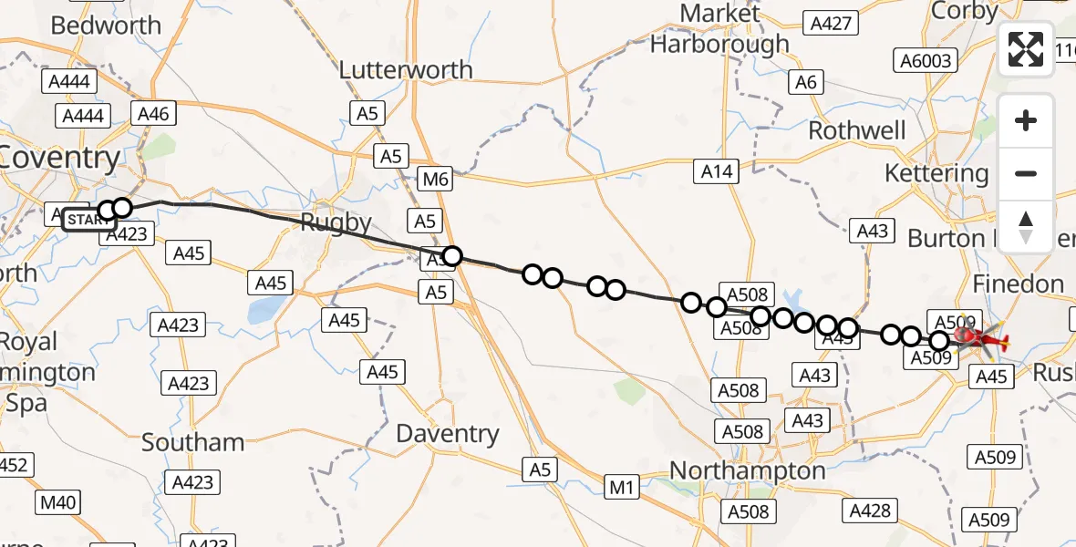
On Saturday, 4 July 2026 at 19:52, a Air Ambulance Helicopter departed from Coventry Airport to Wellingborough. It was the Air Ambulance Helicopter with registration number G-WNAS. The flight lasted 13 minutes. During that period, the aircraft travelled 35 miles at an average speed of 166 miles per hour at a maximum altitude of 1475 feet.

Helicopter: G-WNAS
The helicopter G-WNAS is used as an ambulance helicopter. The helicopter is equipped with a stretcher for transporting patients. The helicopter is often used to transport to hospitals.
Photo: Tony Melony
35 miles
1475 feet
166 mph
13 minutes
19:52
20:05

Route
Cross Road, North Northamptonshire20:05
Wellingborough, North Northamptonshire20:03
Hardwick, North Northamptonshire20:02
Mears Ashby, North Northamptonshire20:02
Sywell, North Northamptonshire20:02
Holcot, West Northamptonshire20:01
Pitsford, West Northamptonshire20:01
Brixworth, West Northamptonshire20:01
Pitsford Water20:01
Brixworth, West Northamptonshire20:00
Northampton, West Northamptonshire20:00
Teeton, West Northamptonshire19:59
Ravensthorpe, West Northamptonshire19:59
West Haddon, West Northamptonshire19:58
Long Buckby, West Northamptonshire19:58
Crick, West Northamptonshire19:57
Rugby, Warwickshire19:53
Tollbar End, Coventry19:52
Rowley Road, West Midlands - Warwickshire19:52
Live flights
Today
Flights Wellingborough
Air Ambulance Helicopter to Coventry Airport15 Jun 16:12
Air Ambulance Helicopter to Coventry Airport24 May 13:28
Police Helicopter to Birmingham Airport12 May 16:08
Police Helicopter to Harborough, Sulby Road3 May 16:09
Helicopter flights on your website?
You can easily display helicopter flights on your own website. Use the embed code.
