Police Helicopter to Harborough, Sulby Road
Sunday, 3 May 2026 | 16:09 | From Wellingborough
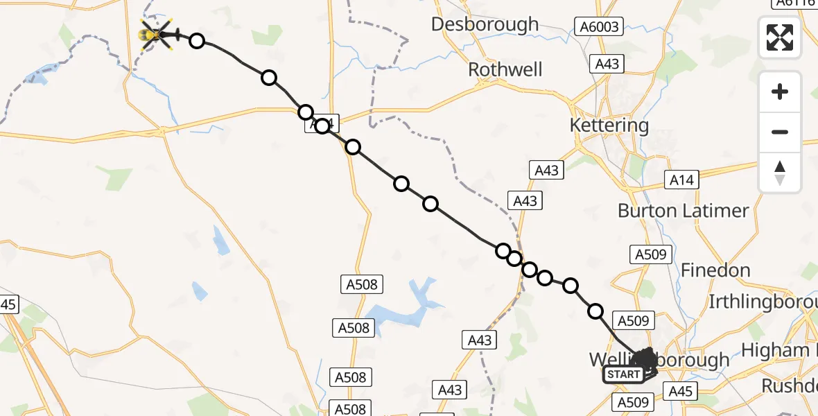
On Sunday, 3 May 2026 at 16:09, a Police Helicopter departed from Wellingborough to Harborough. It was the Police Helicopter with registration number G-EMID. The flight lasted 33 minutes. During that period, the aircraft travelled 38 miles at an average speed of 70 miles per hour at a maximum altitude of 2150 feet.
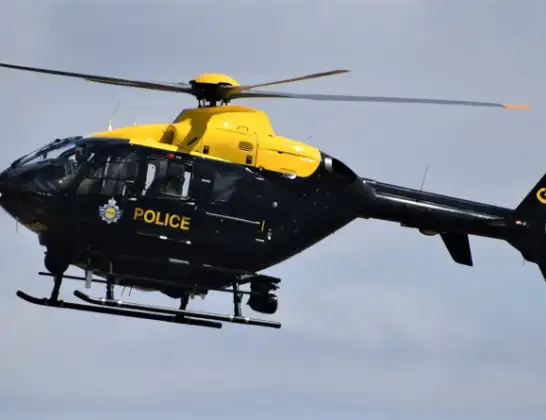
Helicopter: G-EMID
The helicopter G-EMID is used by the British police. The helicopter is deployed in pursuits, missing persons cases and other incidents where a helicopter provides added value.
Photo: Alec Wilson
38 miles
2150 feet
70 mph
33 minutes
16:09
16:42

Route
Sulby Road, West Northamptonshire16:42
Sibbertoft, West Northamptonshire16:41
Clipston, West Northamptonshire16:39
Kelmarsh, West Northamptonshire16:39
Rothwell, West Northamptonshire16:38
Maidwell, West Northamptonshire16:38
Draughton, West Northamptonshire16:37
Lamport, West Northamptonshire16:37
Walgrave, West Northamptonshire16:36
Orlingbury, North Northamptonshire16:35
Hold Farm Airstrip, Northampton, Northamptonshire16:35
Hardwick, North Northamptonshire16:35
Orlingbury, North Northamptonshire16:35
Hardwick, North Northamptonshire16:34
Milton Avenue, North Northamptonshire16:09
Live flights
Today
Police Helicopter to Birmingham Airport17 Jun 23:24
Flights Harborough
Police Helicopter to Sulby, Sulby Road17 Jun 23:14
Police Helicopter to Welford, Sulby Road14 Jun 19:43
Police Helicopter to Sulby, Sulby Road13 Jun 15:30
Police Helicopter to Sulby, Sulby Hall Old Drive12 Jun 18:19
Police Helicopter to Harborough, Sulby Road21 May 22:17
Police Helicopter to Harborough, Sulby Road13 May 14:30
Police Helicopter to Harborough, Sulby Road12 May 13:24
Police Helicopter to Harborough, Sulby Road10 May 22:03
Police Helicopter to Harborough, Sulby Road3 May 16:09
Police Helicopter to Harborough, Sulby Road2 May 18:03
Flights Wellingborough
Air Ambulance Helicopter to Coventry Airport15 Jun 16:12
Air Ambulance Helicopter to Coventry Airport24 May 13:28
Police Helicopter to Birmingham Airport12 May 16:08
Police Helicopter to Harborough, Sulby Road3 May 16:09
Helicopter flights on your website?
You can easily display helicopter flights on your own website. Use the embed code.
