Air Ambulance Helicopter to Slaley, Lead Road
Saturday, 23 May 2026 | 19:02 | From Scales
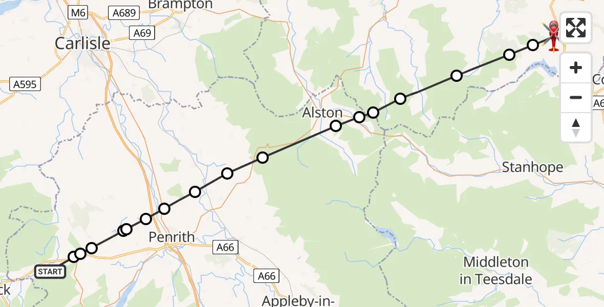
On Saturday, 23 May 2026 at 19:02, a Air Ambulance Helicopter departed from Scales to Slaley. It was the Air Ambulance Helicopter with registration number G-NHAE. The flight lasted 15 minutes. During that period, the aircraft travelled 46 miles at an average speed of 186 miles per hour at a maximum altitude of 2600 feet.
Helicopter: G-NHAE
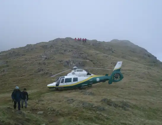
The helicopter G-NHAE is used as a air ambulance helicopter. The main purpose of this aircraft is to transport a Mobile Medical Team to an incident as quickly as possible, enabling the trauma doctor to provide immediate first aid on site. The aircraft is flying this flight as Air Ambulance Helicopter.
Photo: Michael Earnshaw
46 miles
2600 feet
186 mph
15 minutes
19:02
19:17

Route
Lead Road, Northumberland19:17
Slaley, Northumberland19:16
Blanchland, Northumberland19:16
Hexhamshire, Northumberland19:14
Allendale, Northumberland19:12
West Allen, Northumberland19:12
Nenthead, Westmorland and Furness19:11
Alston Moor, Westmorland and Furness19:11
Glassonby, Westmorland and Furness19:08
Gamblesby, Westmorland and Furness19:07
Great Salkeld, Westmorland and Furness19:07
Penrith, Westmorland and Furness19:06
Newton Reigny, Westmorland and Furness19:05
Great Blencow, Westmorland and Furness19:04
Dacre, Westmorland and Furness19:04
Greystoke, Westmorland and Furness19:03
Troutbeck, Westmorland and Furness19:03
Mungrisdale, Westmorland and Furness19:03
A594, Westmorland and Furness19:02
Live flights
Today
Police Helicopter to Hawarden Airport7 Jul 22:14
Coastguard Helicopter to Solent Airport7 Jul 22:09
Flights Slaley
Air Ambulance Helicopter to Slaley, Lead Road23 May 19:02
Air Ambulance Helicopter to Greenhead9 Feb 16:50
Flights Scales
Air Ambulance Helicopter to Above Derwent26 May 13:39
Air Ambulance Helicopter to Slaley, Lead Road23 May 19:02
Helicopter flights on your website?
You can easily display helicopter flights on your own website. Use the embed code.
