Air Ambulance Helicopter to Musgrove Hospital
Thursday, 14 May 2026 | 13:09 | From Street
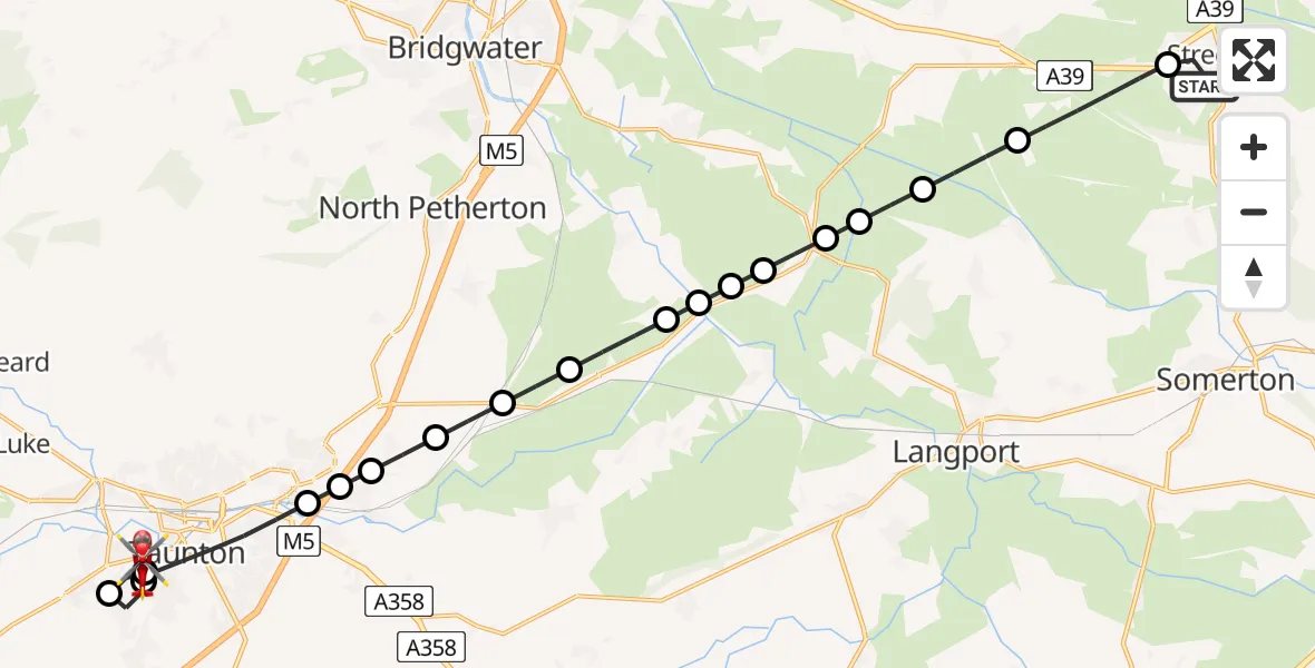
On Thursday, 14 May 2026 at 13:09, a Air Ambulance Helicopter departed from Street to Musgrove Hospital. It was the Air Ambulance Helicopter with registration number G-MGPS. The flight lasted 13 minutes. During that period, the aircraft travelled 20 miles at an average speed of 94 miles per hour at a maximum altitude of 1325 feet.
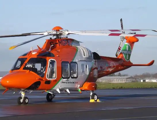
Helicopter: G-MGPS
The helicopter G-MGPS is used as a air ambulance helicopter. The main purpose of this aircraft is to transport a Mobile Medical Team to an incident as quickly as possible, enabling the trauma doctor to provide immediate first aid on site. The aircraft is flying this flight as Air Ambulance Helicopter.
Photo: James
21 miles
1325 feet
94 mph
14 minutes
13:09
13:22

Route
Musgrove Hospital, Taunton13:22
Musgrove Hospital, Taunton13:21
Musgrove Hospital, Taunton13:20
Taunton, Somerset13:20
Trull, Somerset13:19
Taunton, Somerset13:17
Creech St. Michael, Somerset13:17
Taunton, Somerset13:17
Creech St. Michael, Somerset13:16
Taunton, Somerset13:16
East Lyng, Somerset13:15
Burrowbridge, Somerset13:14
Bridgwater, Somerset13:14
Burrowbridge, Somerset13:14
Middlezoy, Somerset13:14
Othery, Somerset13:13
Bridgwater, Somerset13:13
Aller, Somerset13:12
High Ham, Somerset13:12
A39, Somerset13:10
Street, Somerset13:09
Live flights
Today
Flights Street
Air Ambulance Helicopter to Musgrove Hospital14 May 13:09
Air Ambulance Helicopter to Street, Middle Leigh14 May 11:43
Air Ambulance Helicopter to Highworth23 Feb 11:29
Helicopter flights on your website?
You can easily display helicopter flights on your own website. Use the embed code.
