Air Ambulance Helicopter to Westcott, Pilgrims' Way
Thursday, 30 April 2026 | 20:58 | From Redhill Aerodrome
On Thursday, 30 April 2026 at 20:58, a Air Ambulance Helicopter departed from Redhill Aerodrome to Westcott. It was the Air Ambulance Helicopter with registration number G-KSSC. The flight lasted 15 minutes. During that period, the aircraft travelled 18 miles at an average speed of 70 miles per hour at a maximum altitude of 1225 feet.
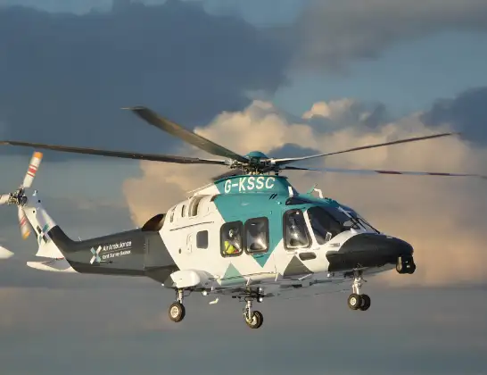
Helicopter: G-KSSC
The helicopter G-KSSC is used as a air ambulance helicopter. The main purpose of this aircraft is to transport a Mobile Medical Team to an incident as quickly as possible, enabling the trauma doctor to provide immediate first aid on site. The aircraft is flying this flight as Air Ambulance Helicopter.
Photo: Shona aakss
18 miles
1225 feet
70 mph
16 minutes
20:58
21:14

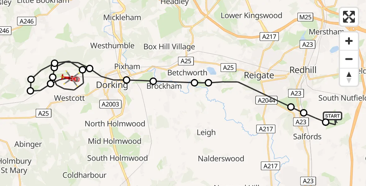
Route
Pilgrims' Way, Surrey21:14
Westcott, Surrey21:13
Mole Valley, Surrey21:12
Guildford, Surrey21:12
Mole Valley, Surrey21:11
Westhumble, Surrey21:11
Westcott, Surrey21:10
Mole Valley, Surrey21:09
Westhumble, Surrey21:09
Dorking, Surrey21:08
Pixham, Surrey21:07
Betchworth, Surrey21:07
Buckland, Surrey21:06
Reigate, Surrey21:05
Redhill, Surrey21:05
Salfords, Surrey21:04
Redhill Aerodrome, Redhill, Surrey21:04
Redhill Aerodrome, Redhill, Surrey20:58
Live flights
Today
Police Helicopter to Birmingham Airport16 Jun 23:29
Coastguard Helicopter to North Atlantic Ocean16 Jun 23:11
Air Ambulance Helicopter to Redhill Aerodrome16 Jun 22:57
Police Helicopter to Manchester Barton Aerodrome16 Jun 22:23
Coastguard Helicopter to Mealabost16 Jun 22:22
Police Helicopter to Sewardstonebury, Green Lane16 Jun 22:04
Police Helicopter to North Weald Airfield16 Jun 22:02
Flights Westcott
Air Ambulance Helicopter to Redhill Aerodrome20 Mar 20:57
Helicopter flights on your website?
You can easily display helicopter flights on your own website. Use the embed code.
