Police Helicopter to Harborough, Sulby Road
Wednesday, 29 April 2026 | 20:48 | From Sibbertoft
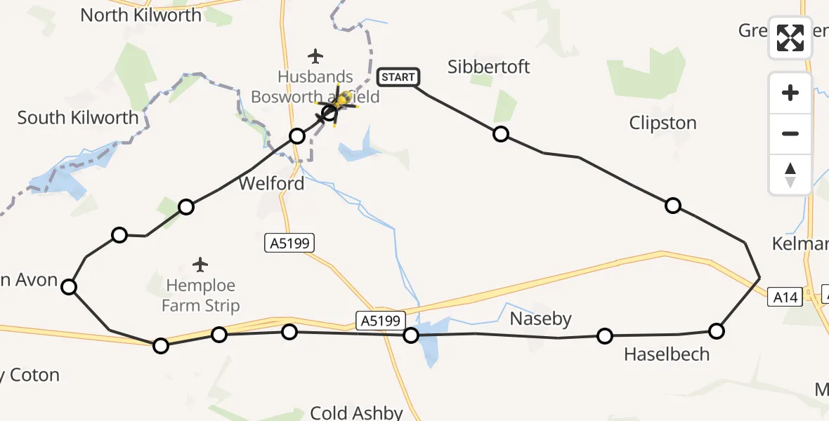
On Wednesday, 29 April 2026 at 20:48, a Police Helicopter departed from Sibbertoft to Harborough. It was the Police Helicopter with registration number G-EMID. The flight lasted 8 minutes. During that period, the aircraft travelled 17 miles at an average speed of 122 miles per hour at a maximum altitude of 1275 feet.
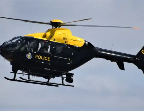
Helicopter: G-EMID
The helicopter G-EMID is used by the British police. The helicopter is deployed in pursuits, missing persons cases and other incidents where a helicopter provides added value.
Photo: Alec Wilson
17 miles
1275 feet
122 mph
9 minutes
20:48
20:56

Route
Sulby Road, Leicestershire20:56
Harborough, Leicestershire20:56
Husbands Bosworth, Leicestershire20:56
Welford, West Northamptonshire20:55
Stanford, West Northamptonshire20:54
Stanford on Avon, West Northamptonshire20:54
Clay Coton, West Northamptonshire20:53
Elkington, West Northamptonshire20:53
Welford, West Northamptonshire20:53
Cold Ashby, West Northamptonshire20:52
Naseby, West Northamptonshire20:51
Haselbech, West Northamptonshire20:51
Kelmarsh, West Northamptonshire20:50
Clipston, West Northamptonshire20:49
Welford Road, West Northamptonshire20:48
Live flights
Today
Flights Harborough
Police Helicopter to Welford, Sulby Road14 Jun 19:43
Police Helicopter to Sulby, Sulby Road13 Jun 15:30
Police Helicopter to Sulby, Sulby Hall Old Drive12 Jun 18:19
Police Helicopter to Harborough, Sulby Road21 May 22:17
Police Helicopter to Harborough, Sulby Road13 May 14:30
Police Helicopter to Harborough, Sulby Road12 May 13:24
Police Helicopter to Harborough, Sulby Road10 May 22:03
Police Helicopter to Harborough, Sulby Road3 May 16:09
Police Helicopter to Harborough, Sulby Road2 May 18:03
Police Helicopter to Harborough, Sulby Road1 May 22:48
Flights Sibbertoft
Police Helicopter to Welford, Sulby Road14 Jun 00:11
Police Helicopter to Sibbertoft, Welford Road12 Jun 18:27
Police Helicopter to Harborough, Sulby Road29 Apr 20:48
Police Helicopter to Harborough, Sulby Road27 Apr 21:30
Police Helicopter to Husbands Bosworth Airfield27 Apr 19:02
Police Helicopter to Husbands Bosworth Airfield26 Apr 19:25
Police Helicopter to Sulby Airstrip21 Apr 17:41
Police Helicopter to Harborough, Sulby Road20 Apr 16:29
Police Helicopter to Sibbertoft, Welford Road17 Apr 23:38
Helicopter flights on your website?
You can easily display helicopter flights on your own website. Use the embed code.
