Air Ambulance Helicopter to Peasemore, Hillgreen Lane
Wednesday, 29 April 2026 | 10:59 | From RAF Benson
On Wednesday, 29 April 2026 at 10:59, a Air Ambulance Helicopter departed from RAF Benson to Peasemore. It was the Air Ambulance Helicopter with registration number G-TVLY. The flight lasted 11 minutes. During that period, the aircraft travelled 20 miles at an average speed of 111 miles per hour at a maximum altitude of 1375 feet.
Helicopter: G-TVLY
The helicopter G-TVLY is used as a air ambulance helicopter. The main purpose of this aircraft is to transport a Mobile Medical Team to an incident as quickly as possible, enabling the trauma doctor to provide immediate first aid on site. The aircraft is flying this flight as Air Ambulance Helicopter.
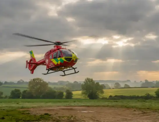
Photo: Tony Melony
21 miles
1375 feet
111 mph
12 minutes
10:59
11:10

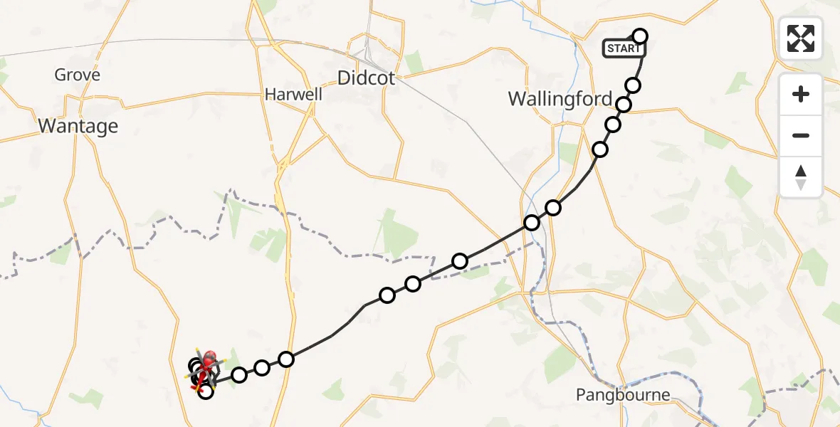
Route
Hillgreen Lane, West Berkshire11:10
Peasemore, West Berkshire11:10
Leckhampstead, West Berkshire11:09
Peasemore, West Berkshire11:08
Leckhampstead, West Berkshire11:08
Peasemore, West Berkshire11:07
Leckhampstead, West Berkshire11:06
Peasemore, West Berkshire11:06
Beedon, West Berkshire11:06
World's End, West Berkshire11:05
Compton, West Berkshire11:04
Aldworth, West Berkshire11:04
Streatley, West Berkshire11:03
Moulsford, Oxfordshire11:03
South Stoke, Oxfordshire11:02
North Stoke, Oxfordshire11:02
South Oxfordshire, Oxfordshire11:01
Crowmarsh Gifford, Oxfordshire11:01
Benson, Oxfordshire11:01
Ewelme, Oxfordshire11:00
RAF Benson, Wallingford, Oxfordshire11:00
RAF Benson, Wallingford, Oxfordshire10:59
Live flights
Today
Air Ambulance Helicopter to Derriford Hospital29 Jul 22:42
Police Helicopter to Manchester Barton Aerodrome29 Jul 22:41
Air Ambulance Helicopter to Henstridge Airfield29 Jul 22:24
Police Helicopter to Banknock, Hazel Road29 Jul 22:12
Police Helicopter to MOD St Athan29 Jul 22:10
Police Helicopter to Almondsbury Helicopter Base29 Jul 21:53
Air Ambulance Helicopter to RAF Northolt29 Jul 21:51
Flights Peasemore
Air Ambulance Helicopter to Cumnor, Eynsham Road29 Apr 12:36
Helicopter flights on your website?
You can easily display helicopter flights on your own website. Use the embed code.
