Police Helicopter to Nantgarw, Oxford Street
Tuesday, 28 April 2026 | 15:13 | From Pontypridd
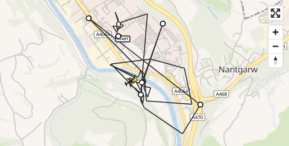
On Tuesday, 28 April 2026 at 15:13, a Police Helicopter departed from Pontypridd to Nantgarw. It was the Police Helicopter with registration number G-NWOI. The flight lasted 13 minutes. During that period, the aircraft travelled 6 miles at an average speed of 28 miles per hour at a maximum altitude of 800 feet.
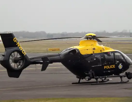
Helicopter: G-NWOI
The helicopter G-NWOI is used by the British police. The helicopter is deployed in pursuits, missing persons cases and other incidents where a helicopter provides added value.
Photo: James from Cheltenham
7 miles
800 feet
28 mph
14 minutes
15:13
15:27

Route
Oxford Street, Rhondda Cynon Taf15:27
Nantgarw, Rhondda Cynon Taf15:25
Upper Boat, Rhondda Cynon Taf15:25
Nantgarw, Rhondda Cynon Taf15:19
Pontypridd, Rhondda Cynon Taf15:19
Nantgarw, Rhondda Cynon Taf15:17
Upper Boat, Rhondda Cynon Taf15:13
St David's Close, Rhondda Cynon Taf15:13
Live flights
Today
Police Helicopter to Birtley18:48:27
Flights Nantgarw
Flights Pontypridd
Air Ambulance Helicopter to Cardiff Heliport26 Apr 17:04
Police Helicopter to Pontypridd, A405417 Apr 16:06
Air Ambulance Helicopter to Dafen, Heol Aur16 Apr 17:01
Air Ambulance Helicopter to Pontypridd16 Apr 16:02
Air Ambulance Helicopter to Pontypridd16 Apr 15:43
Helicopter flights on your website?
You can easily display helicopter flights on your own website. Use the embed code.
