Police Helicopter to Pontypridd, A4054
Friday, 17 April 2026 | 16:06 | From Boverton
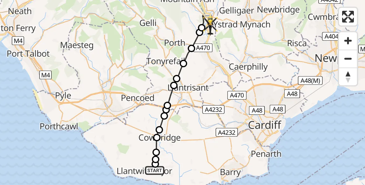
On Friday, 17 April 2026 at 16:06, a Police Helicopter departed from Boverton to Pontypridd. It was the Police Helicopter with registration number G-NWOI. The flight lasted 8 minutes. During that period, the aircraft travelled 19 miles at an average speed of 139 miles per hour at a maximum altitude of 3200 feet.
Helicopter: G-NWOI
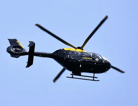
The helicopter G-NWOI is used by the British police. The helicopter is deployed in pursuits, missing persons cases and other incidents where a helicopter provides added value.
Photo: Alec Wilson
20 miles
3200 feet
139 mph
9 minutes
16:06
16:14

Route
A4054, Rhondda Cynon Taf16:14
Abercynon, Rhondda Cynon Taf16:13
Cilfynydd, Rhondda Cynon Taf16:13
Pontypridd, Rhondda Cynon Taf16:12
Tonyrefail, Rhondda Cynon Taf16:12
Llantrisant, Rhondda Cynon Taf16:11
Llanharan, Rhondda Cynon Taf16:11
Llanharry, Rhondda Cynon Taf16:10
Brynsadler, Rhondda Cynon Taf16:09
Ystradowen, Vale of Glamorgan16:09
Pen-y-lan, Vale of Glamorgan16:08
Cowbridge, Vale of Glamorgan16:08
Llandough, Vale of Glamorgan16:07
St Mary Church, Vale of Glamorgan16:07
Llanmaes, Vale of Glamorgan16:06
Northern Access Road, Vale of Glamorgan16:06
Live flights
Police Helicopter on its way from Loughton27 Jul 23:32
Police Helicopter on its way from Sheldon27 Jul 23:21
Police Helicopter on its way from Welford27 Jul 23:04
Police Helicopter on its way from RAF Benson27 Jul 22:46
Today
Police Helicopter to Manchester Barton Aerodrome27 Jul 22:40
Police Helicopter to Hawarden Airport27 Jul 22:37
Air Ambulance Aircraft to Inner Seas27 Jul 22:22
Police Helicopter to Connah's Quay27 Jul 21:55
Police Helicopter to East Ardsley, Stoney Lane27 Jul 21:40
Air Ambulance Helicopter to Nottingham Heliport27 Jul 21:28
Air Ambulance Helicopter to RAF Northolt27 Jul 21:04
Police Helicopter to Manchester Barton Aerodrome27 Jul 21:00
Police Helicopter to Birmingham Airport27 Jul 20:59
Flights Pontypridd
Police Helicopter to MOD St Athan20 Jul 15:35
Police Helicopter to Pontypridd, Garth Avenue20 Jul 15:22
Police Helicopter to Pontypridd, Llantwit Road30 Jun 22:04
Police Helicopter to MOD St Athan28 May 17:59
Police Helicopter to Nantgarw, Oxford Street28 Apr 15:13
Air Ambulance Helicopter to Cardiff Heliport26 Apr 17:04
Police Helicopter to Pontypridd, A405417 Apr 16:06
Air Ambulance Helicopter to Dafen, Heol Aur16 Apr 17:01
Flights Boverton
Police Helicopter to Crofty25 Jul 19:37
Police Helicopter to North Devon, Nutcombe Hill25 Jul 08:57
Police Helicopter to MOD St Athan25 Jul 02:38
Police Helicopter to Tredegar, Manmoel Road24 Jul 20:00
Police Helicopter to MOD St Athan21 Jul 21:05
Police Helicopter to MOD St Athan21 Jul 19:47
Police Helicopter to MOD St Athan20 Jul 20:33
Police Helicopter to MOD St Athan20 Jul 19:51
Police Helicopter to Pontypridd, Garth Avenue20 Jul 15:22
Police Helicopter to Bridgend, Min Y Coed18 Jul 15:09
Helicopter flights on your website?
You can easily display helicopter flights on your own website. Use the embed code.
