Air Ambulance Helicopter to Pontypridd, Oak Street
Sunday, 26 April 2026 | 16:05 | From Cardiff Heliport
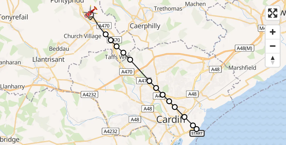
On Sunday, 26 April 2026 at 16:05, a Air Ambulance Helicopter departed from Cardiff Heliport to Pontypridd. It was the Air Ambulance Helicopter with registration number G-WROL. The flight lasted 8 minutes. During that period, the aircraft travelled 12 miles at an average speed of 93 miles per hour at a maximum altitude of 1225 feet.
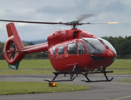
Helicopter: G-WROL
The helicopter G-WROL is used as a air ambulance helicopter. The main purpose of this aircraft is to transport a Mobile Medical Team to an incident as quickly as possible, enabling the trauma doctor to provide immediate first aid on site. The aircraft is flying this flight as Air Ambulance Helicopter.
Photo: James from Cheltenham, Gloucestershire
13 miles
1225 feet
93 mph
8 minutes
16:05
16:12

Route
Oak Street, Rhondda Cynon Taf16:12
Pontypridd, Rhondda Cynon Taf16:10
Nantgarw, Rhondda Cynon Taf16:10
Gwaelod-y-garth, Cardiff16:10
Taffs Well, Rhondda Cynon Taf16:10
Tongwynlais, Cardiff16:09
Pantmawr, Cardiff16:09
Birchgrove, Cardiff16:08
Mynachdy, Cardiff16:08
Maindy, Cardiff16:08
Plasnewydd, Cardiff16:08
Adamsdown, Cardiff16:07
Selwyn Morris Court, Cardiff16:07
Pengam Green, Cardiff16:07
Cardiff Heliport, Cardiff16:06
Cardiff Heliport, Cardiff16:05
Cardiff Heliport, Cardiff16:05
Live flights
Police Helicopter on its way from Loughton27 Jul 23:32
Police Helicopter on its way from Sheldon27 Jul 23:21
Police Helicopter on its way from Welford27 Jul 23:04
Police Helicopter on its way from RAF Benson27 Jul 22:46
Today
Police Helicopter to Manchester Barton Aerodrome27 Jul 22:40
Police Helicopter to Hawarden Airport27 Jul 22:37
Air Ambulance Aircraft to Inner Seas27 Jul 22:22
Police Helicopter to Connah's Quay27 Jul 21:55
Police Helicopter to East Ardsley, Stoney Lane27 Jul 21:40
Air Ambulance Helicopter to Nottingham Heliport27 Jul 21:28
Air Ambulance Helicopter to RAF Northolt27 Jul 21:04
Police Helicopter to Manchester Barton Aerodrome27 Jul 21:00
Police Helicopter to Birmingham Airport27 Jul 20:59
Flights Pontypridd
Police Helicopter to MOD St Athan20 Jul 15:35
Police Helicopter to Pontypridd, Garth Avenue20 Jul 15:22
Police Helicopter to Pontypridd, Llantwit Road30 Jun 22:04
Police Helicopter to MOD St Athan28 May 17:59
Police Helicopter to Nantgarw, Oxford Street28 Apr 15:13
Air Ambulance Helicopter to Cardiff Heliport26 Apr 17:04
Police Helicopter to Pontypridd, A405417 Apr 16:06
Air Ambulance Helicopter to Dafen, Heol Aur16 Apr 17:01
Helicopter flights on your website?
You can easily display helicopter flights on your own website. Use the embed code.
