Air Ambulance Helicopter to Stranraer
Sunday, 26 April 2026 | 3:59 | From Glasgow Airport
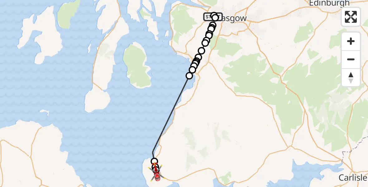
On Sunday, 26 April 2026 at 3:59, a Air Ambulance Helicopter departed from Glasgow Airport to Stranraer. It was the Air Ambulance Helicopter with registration number G-ISAS. The flight lasted 32 minutes. During that period, the aircraft travelled 72 miles at an average speed of 134 miles per hour at a maximum altitude of 1750 feet.
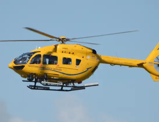
Helicopter: G-ISAS
The helicopter G-ISAS is used as a air ambulance helicopter. The main purpose of this aircraft is to transport a Mobile Medical Team to an incident as quickly as possible, enabling the trauma doctor to provide immediate first aid on site. The aircraft is flying this flight as Air Ambulance Helicopter.
Photo: Jonathan Payne
72 miles
1750 feet
134 mph
33 minutes
03:59
04:32

Route
Stranraer, Dumfries and Galloway04:32
Cairnryan, Dumfries and Galloway04:31
Kirkcolm Point, Dumfries and Galloway04:31
Cairnryan, Dumfries and Galloway04:30
Inner Seas04:12
Troon, South Ayrshire04:11
Loans, South Ayrshire04:10
Drybridge, North Ayrshire04:10
Dundonald, South Ayrshire04:10
Drybridge, North Ayrshire04:09
Springside, North Ayrshire04:09
Cunninghamhead, North Ayrshire04:07
Stewarton, East Ayrshire04:06
Dunlop, East Ayrshire04:05
Hazelbank Farm, East Ayrshire04:04
Uplawmoor, East Renfrewshire04:04
Neilston, East Renfrewshire04:03
Gateside, East Renfrewshire04:03
Elderslie, Renfrewshire04:02
Paisley, Renfrewshire04:01
Kirkfield Gardens, Renfrewshire04:00
Renfrew, Renfrewshire04:00
Glasgow Airport, Glasgow03:59
Live flights
Today
Flights Stranraer
Air Ambulance Helicopter to Glasgow Airport23 May 23:51
Air Ambulance Helicopter to Knee of Cairnsmore18 May 15:52
Air Ambulance Helicopter to Stranraer18 May 13:06
Air Ambulance Helicopter to Pinmore4 May 17:17
Air Ambulance Helicopter to Stranraer4 May 16:22
Air Ambulance Helicopter to Laurieston26 Apr 06:19
Air Ambulance Helicopter to Stranraer26 Apr 03:59
Air Ambulance Helicopter to Glasgow Airport16 Mar 18:49
Helicopter flights on your website?
You can easily display helicopter flights on your own website. Use the embed code.
