Police Helicopter to Upper Hartfield, Parrock Lane
Saturday, 25 April 2026 | 15:25 | From Outwood
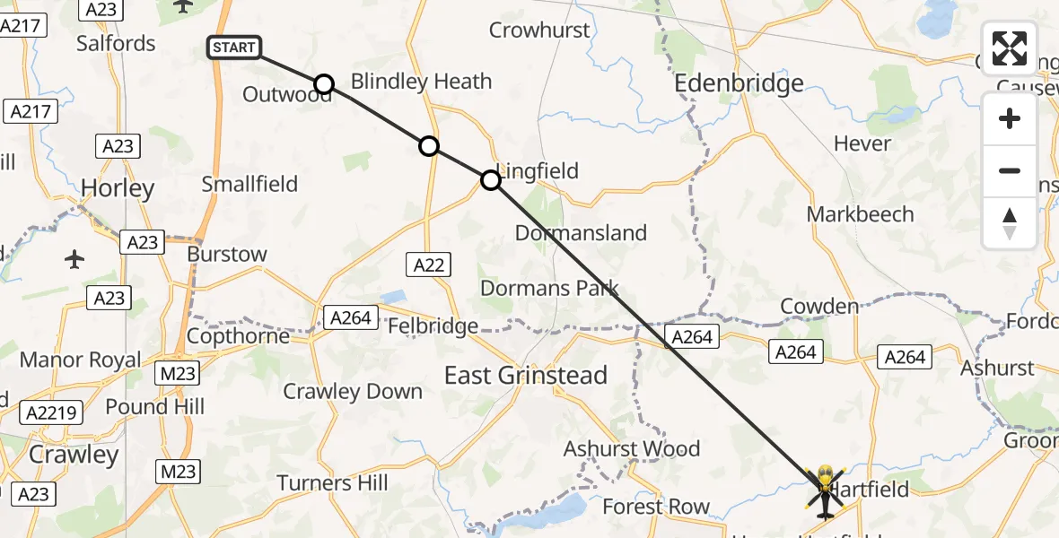
On Saturday, 25 April 2026 at 15:25, a Police Helicopter departed from Outwood to Upper Hartfield. It was the Police Helicopter with registration number G-POLH. The flight lasted 5 minutes. During that period, the aircraft travelled 12 miles at an average speed of 139 miles per hour at a maximum altitude of 800 feet.
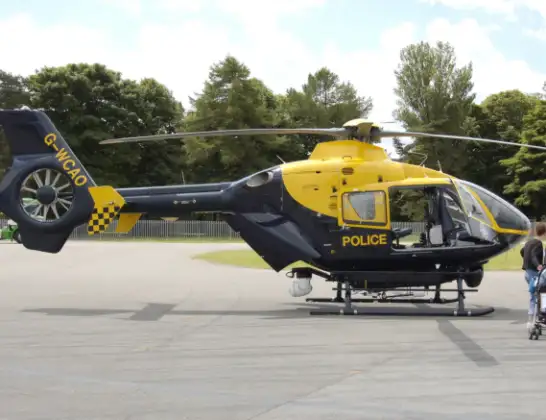
Helicopter: G-POLH
The helicopter G-POLH is used by the British police. The helicopter is deployed in pursuits, missing persons cases and other incidents where a helicopter provides added value.
Photo: Arpingstone
12 miles
800 feet
139 mph
6 minutes
15:25
15:30

Route
Parrock Lane, East Sussex15:30
Lingfield, Surrey15:27
Blindley Heath, Surrey15:26
Tandridge, Surrey15:25
Prince of Wales Road, Surrey15:25
Live flights
Police Helicopter on its way from East Ardsley24 Jul 23:19
Today
Air Ambulance Helicopter to Henstridge Airfield24 Jul 23:34
Air Ambulance Helicopter to Cowbridge, A4824 Jul 23:07
Police Helicopter to North Weald Airfield24 Jul 22:53
Air Ambulance Helicopter to Caernarfon Airport24 Jul 22:42
Police Helicopter to Rockbeare, Westcott Road24 Jul 22:17
Police Helicopter to Almondsbury Helicopter Base24 Jul 22:17
Police Helicopter to MOD St Athan24 Jul 22:16
Flights Outwood
Police Helicopter to Tandridge, Moats Lane5 May 20:04
Police Helicopter to Salfords, Kings Mill Lane25 Apr 16:27
Police Helicopter to South Nutfield, Ridge Green24 Jan 17:49
Helicopter flights on your website?
You can easily display helicopter flights on your own website. Use the embed code.
