Air Ambulance Helicopter to Cornwall Airport Newquay
Saturday, 25 April 2026 | 14:11 | From Ernesettle
On Saturday, 25 April 2026 at 14:11, a Air Ambulance Helicopter departed from Ernesettle to Cornwall Airport Newquay. It was the Air Ambulance Helicopter with registration number G-CRWL. The flight lasted 15 minutes. During that period, the aircraft travelled 35 miles at an average speed of 142 miles per hour at a maximum altitude of 1300 feet.
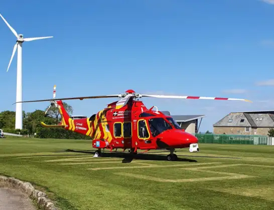
Helicopter: G-CRWL
The helicopter G-CRWL is used as a air ambulance helicopter. The main purpose of this aircraft is to transport a Mobile Medical Team to an incident as quickly as possible, enabling the trauma doctor to provide immediate first aid on site. The aircraft is flying this flight as Air Ambulance Helicopter.
Photo: Jowaninpensans
36 miles
1300 feet
142 mph
15 minutes
14:11
14:26

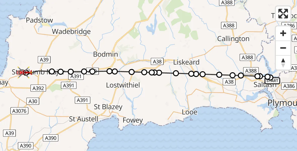
Route
Cornwall Airport Newquay, Newquay14:26
Cornwall Airport Newquay, Newquay14:25
St. Columb Major, Cornwall14:23
St. Wenn, Cornwall14:22
Withiel, Cornwall14:22
Lanivet, Cornwall14:21
Luxulyan, Cornwall14:21
Lanivet, Cornwall14:20
Trebyan, Cornwall14:19
St. Winnow, Cornwall14:19
Broadoak, Cornwall14:18
East Taphouse, Cornwall14:17
Lanreath, Cornwall14:17
East Taphouse, Cornwall14:17
St. Pinnock, Cornwall14:16
St. Keyne and Trewidland, Cornwall14:15
Menheniot, Cornwall14:15
Liskeard, Cornwall14:15
St. Germans, Cornwall14:14
Tideford, Cornwall14:13
Landrake, Cornwall14:13
Saltash, Cornwall14:12
Botus Fleming, Cornwall14:12
Saltash, Cornwall14:11
Plymouth14:11
Ernesettle Lane, Plymouth14:11
Live flights
Police Helicopter on its way from East Ardsley24 Jul 23:19
Today
Police Helicopter to North Weald Airfield24 Jul 22:53
Air Ambulance Helicopter to Caernarfon Airport24 Jul 22:42
Police Helicopter to Rockbeare, Westcott Road24 Jul 22:17
Police Helicopter to Almondsbury Helicopter Base24 Jul 22:17
Police Helicopter to MOD St Athan24 Jul 22:16
Flights Ernesettle
Air Ambulance Helicopter to Ernesettle25 Apr 13:30
Helicopter flights on your website?
You can easily display helicopter flights on your own website. Use the embed code.
