Air Ambulance Helicopter to Ernesettle, Tamar Bridge
Saturday, 25 April 2026 | 13:16 | From Lanivet
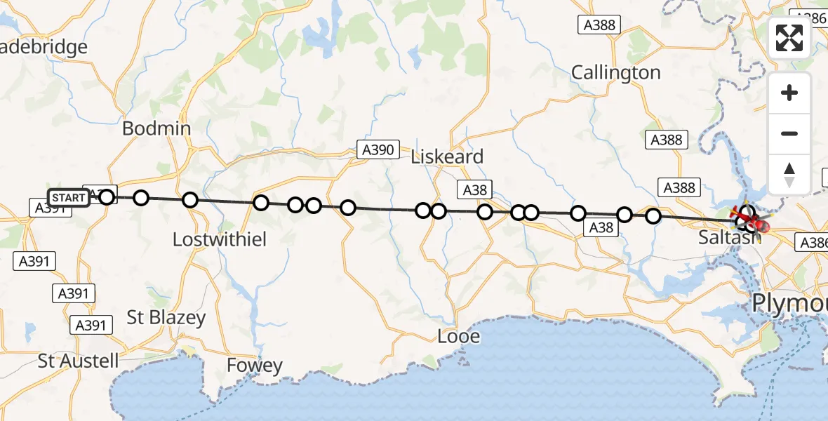
On Saturday, 25 April 2026 at 13:16, a Air Ambulance Helicopter departed from Lanivet to Ernesettle. It was the Air Ambulance Helicopter with registration number G-CRWL. The flight lasted 12 minutes. During that period, the aircraft travelled 28 miles at an average speed of 138 miles per hour at a maximum altitude of 1175 feet.
Helicopter: G-CRWL
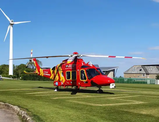
The helicopter G-CRWL is used as a air ambulance helicopter. The main purpose of this aircraft is to transport a Mobile Medical Team to an incident as quickly as possible, enabling the trauma doctor to provide immediate first aid on site. The aircraft is flying this flight as Air Ambulance Helicopter.
Photo: Jowaninpensans
29 miles
1175 feet
138 mph
13 minutes
13:16
13:29

Route
Tamar Bridge, Cornwall13:29
Plymouth13:29
Ernesettle, Plymouth13:28
Plymouth13:27
Saltash, Cornwall13:26
Landrake, Cornwall13:25
Tideford, Cornwall13:25
St. Germans, Cornwall13:24
Liskeard, Cornwall13:24
Menheniot, Cornwall13:23
St. Keyne and Trewidland, Cornwall13:22
Duloe, Cornwall13:22
St. Pinnock, Cornwall13:21
East Taphouse, Cornwall13:20
Boconnoc, Cornwall13:20
St. Winnow, Cornwall13:19
Lostwithiel, Cornwall13:18
Lanivet, Cornwall13:18
Luxulyan, Cornwall13:17
Old Coach Road, Cornwall13:16
Live flights
Police Helicopter on its way from East Ardsley24 Jul 23:19
Today
Police Helicopter to North Weald Airfield24 Jul 22:53
Air Ambulance Helicopter to Caernarfon Airport24 Jul 22:42
Police Helicopter to Rockbeare, Westcott Road24 Jul 22:17
Police Helicopter to Almondsbury Helicopter Base24 Jul 22:17
Police Helicopter to East Ardsley, Stoney Lane24 Jul 21:51
Flights Ernesettle
Air Ambulance Helicopter to Ernesettle25 Apr 13:30
Flights Lanivet
Air Ambulance Helicopter to Derriford Hospital13 Jul 15:48
Helicopter flights on your website?
You can easily display helicopter flights on your own website. Use the embed code.
