Air Ambulance Helicopter to Edenhall, Ladies Walk
Tuesday, 21 April 2026 | 8:41 | From Stanhope
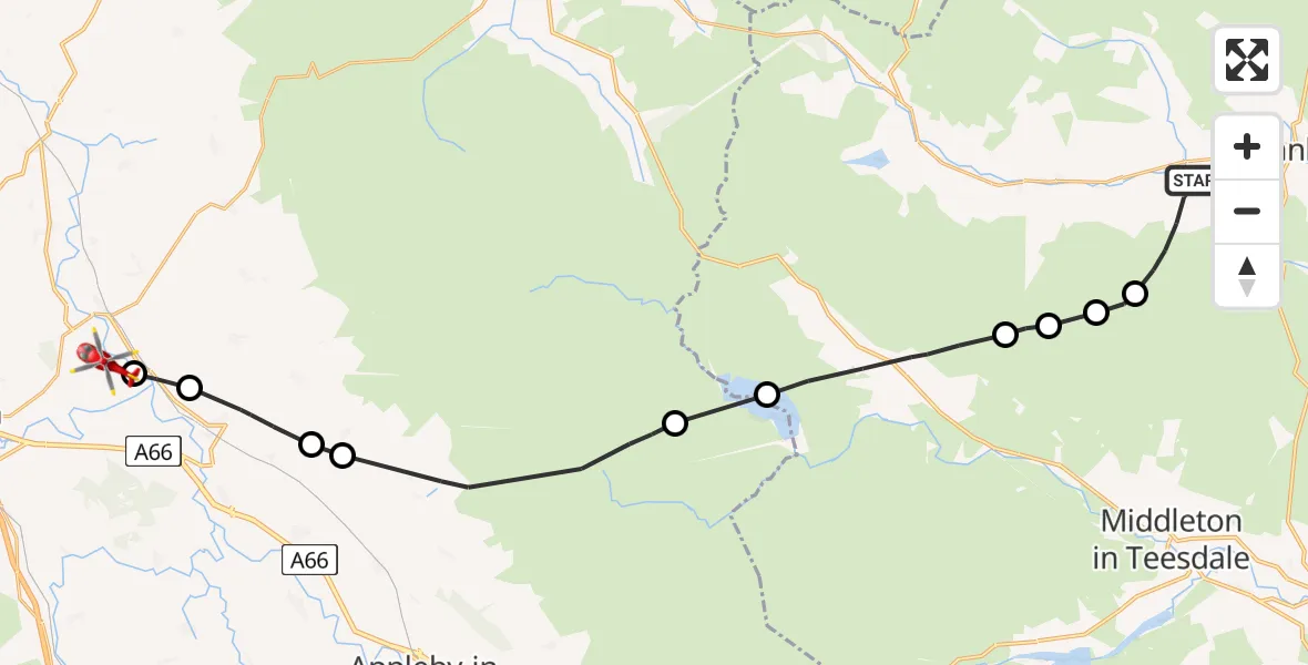
On Tuesday, 21 April 2026 at 8:41, a Air Ambulance Helicopter departed from Stanhope to Edenhall. It was the Air Ambulance Helicopter with registration number G-NHAE. The flight lasted 9 minutes. During that period, the aircraft travelled 27 miles at an average speed of 174 miles per hour at a maximum altitude of 3550 feet.
Helicopter: G-NHAE
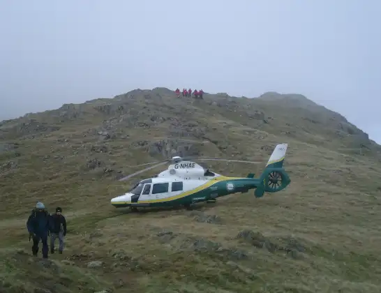
The helicopter G-NHAE is used as a air ambulance helicopter. The main purpose of this aircraft is to transport a Mobile Medical Team to an incident as quickly as possible, enabling the trauma doctor to provide immediate first aid on site. The aircraft is flying this flight as Air Ambulance Helicopter.
Photo: Michael Earnshaw
27 miles
3550 feet
174 mph
10 minutes
08:41
08:50

Route
Ladies Walk, Westmorland and Furness08:50
Langwathby, Westmorland and Furness08:50
Culgaith, Westmorland and Furness08:50
Newbiggin, Westmorland and Furness08:49
Milburn, Westmorland and Furness08:48
Dufton, Westmorland and Furness08:46
Cow Green Reservoir08:45
Forest and Frith, County Durham08:44
Newbiggin, County Durham08:43
Stanhope, County Durham08:43
Westgate, County Durham08:42
Stanhope, County Durham08:41
Live flights
Today
Flights Edenhall
Air Ambulance Helicopter to Langwathby, B641211 Jun 14:26
Air Ambulance Helicopter to Edenhall, B641210 Jun 19:23
Air Ambulance Helicopter to Edenhall, B641210 Jun 14:27
Air Ambulance Helicopter to Troutbeck, A669 Jun 17:03
Air Ambulance Helicopter to Edenhall, B64128 Jun 17:21
Air Ambulance Helicopter to Blindcrake, A5957 Jun 14:20
Flights Stanhope
Police Helicopter to Consett13:49:48
Police Helicopter to Stanhope12:57:47
Air Ambulance Helicopter to Stanhope10 May 17:59
Police Helicopter to Durham, B653229 Apr 09:52
Air Ambulance Helicopter to Culgaith, Ousby6 Apr 20:46
Helicopter flights on your website?
You can easily display helicopter flights on your own website. Use the embed code.
