Air Ambulance Helicopter to Shap Rural, Old Corpse Road
Monday, 8 June 2026 | 16:33 | From Edenhall
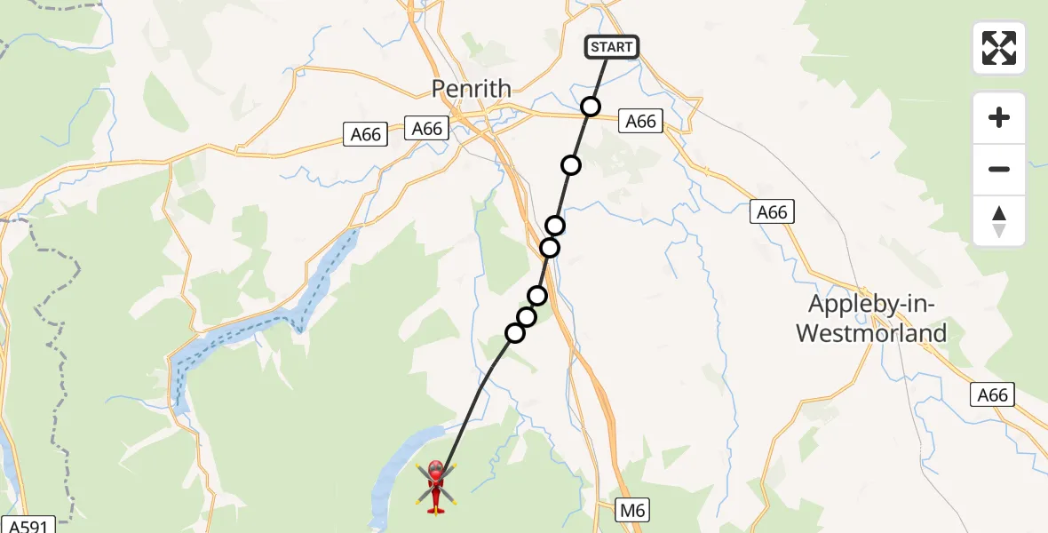
On Monday, 8 June 2026 at 16:33, a Air Ambulance Helicopter departed from Edenhall to Shap Rural. It was the Air Ambulance Helicopter with registration number G-NHAE. The flight lasted 5 minutes. During that period, the aircraft travelled 13 miles at an average speed of 144 miles per hour at a maximum altitude of 2725 feet.
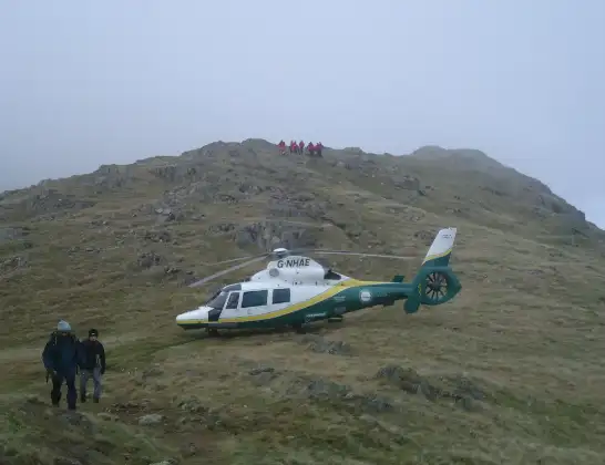
Helicopter: G-NHAE
The helicopter G-NHAE is used as a air ambulance helicopter. The main purpose of this aircraft is to transport a Mobile Medical Team to an incident as quickly as possible, enabling the trauma doctor to provide immediate first aid on site. The aircraft is flying this flight as Air Ambulance Helicopter.
Photo: Michael Earnshaw
13 miles
2725 feet
144 mph
6 minutes
16:33
16:39

Route
Old Corpse Road, Westmorland and Furness16:39
Bampton Grange, Westmorland and Furness16:37
Lowther, Westmorland and Furness16:37
Newtown, Westmorland and Furness16:36
Hackthorpe, Westmorland and Furness16:36
Great Strickland, Westmorland and Furness16:36
Melkinthorpe, Westmorland and Furness16:35
Brougham, Westmorland and Furness16:34
Ladies Walk, Westmorland and Furness16:33
Live flights
Today
Police Helicopter to Hortham, M400:02:34
Flights Edenhall
Air Ambulance Helicopter to Irish Sea30 Jul 11:37
Air Ambulance Helicopter to Edenhall, Brougham16 Jul 14:10
Air Ambulance Helicopter to Edenhall13 Jul 14:27
Air Ambulance Helicopter to Edenhall7 Jul 09:38
Air Ambulance Helicopter to Stainton7 Jul 08:41
Air Ambulance Helicopter to Skirwith1 Jul 09:53
Helicopter flights on your website?
You can easily display helicopter flights on your own website. Use the embed code.
