Police Helicopter to Salfords, Kings Mill Lane
Sunday, 19 April 2026 | 10:53 | From Cranleigh
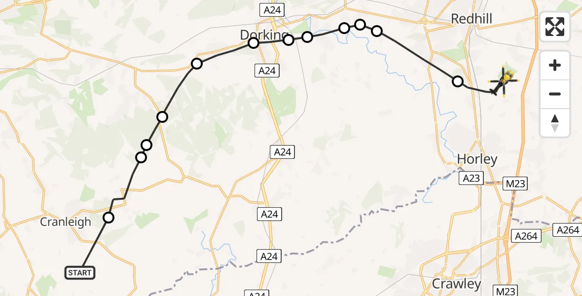
On Sunday, 19 April 2026 at 10:53, a Police Helicopter departed from Cranleigh to Salfords. It was the Police Helicopter with registration number G-POLH. The flight lasted 8 minutes. During that period, the aircraft travelled 20 miles at an average speed of 141 miles per hour at a maximum altitude of 900 feet.
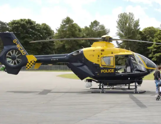
Helicopter: G-POLH
The helicopter G-POLH is used by the British police. The helicopter is deployed in pursuits, missing persons cases and other incidents where a helicopter provides added value.
Photo: Arpingstone
20 miles
900 feet
141 mph
9 minutes
10:53
11:02

Route
Kings Mill Lane, Surrey11:02
Salfords, Surrey11:01
Reigate, Surrey10:59
Buckland, Surrey10:59
Betchworth, Surrey10:59
Brockham, Surrey10:58
Pixham, Surrey10:58
Dorking, Surrey10:58
Westcott, Surrey10:57
Abinger, Surrey10:56
Guildford, Surrey10:55
Holmbury St Mary, Surrey10:55
Ewhurst, Surrey10:54
Vachery Lane, Surrey10:53
Live flights
Police Helicopter on its way from Dundrod12 Jul 22:50
Today
Police Helicopter to East Ardsley, Stoney Lane12 Jul 23:51
Police Helicopter to Birmingham Airport12 Jul 23:46
Air Ambulance Helicopter to Newlands of Culloden12 Jul 23:24
Flights Salfords
Air Ambulance Helicopter to Redhill Aerodrome11 Jul 14:04
Police Helicopter to North Weald Bassett28 Jun 14:38
Air Ambulance Helicopter to Redhill Aerodrome10 Jun 09:33
Police Helicopter to Aldenham, Wards Lane8 Jun 08:55
Police Helicopter to South Nutfield, M236 Jun 19:01
Police Helicopter to Redhill Aerodrome6 Jun 00:03
Police Helicopter to Fishbourne, Westgate4 Jun 11:45
Flights Cranleigh
Police Helicopter to Salfords, Kings Mill Lane19 Apr 10:53
Police Helicopter to Cranleigh, Knowle Lane19 Apr 10:40
Air Ambulance Helicopter to Redhill Aerodrome16 Feb 13:56
Police Helicopter to Cranleigh, Cooks Hill25 Jan 11:57
Helicopter flights on your website?
You can easily display helicopter flights on your own website. Use the embed code.
