Air Ambulance Helicopter to Cranleigh, Amlets Lane
Monday, 16 February 2026 | 12:50 | From Redhill Aerodrome
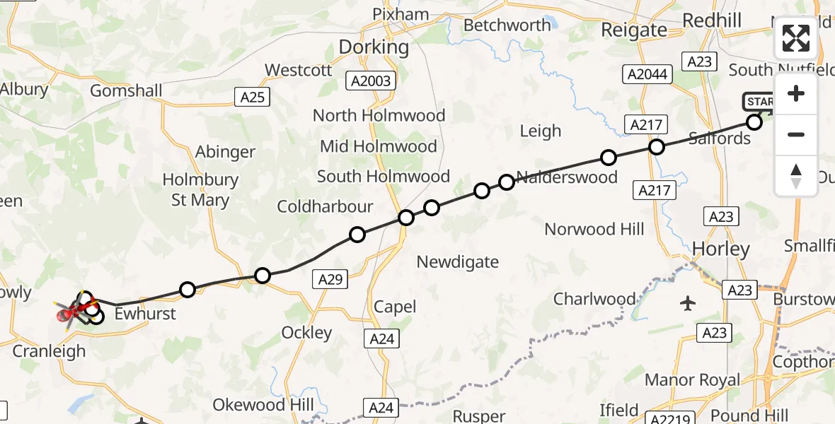
On Monday, 16 February 2026 at 12:50, a Air Ambulance Helicopter departed from Redhill Aerodrome to Cranleigh. It was the Air Ambulance Helicopter with registration number G-LNAC. The flight lasted 13 minutes. During that period, the aircraft travelled 17 miles at an average speed of 76 miles per hour at a maximum altitude of 1425 feet.
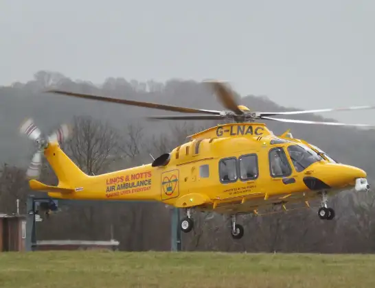
Helicopter: G-LNAC
The helicopter G-LNAC is used as a air ambulance helicopter. The main purpose of this aircraft is to transport a Mobile Medical Team to an incident as quickly as possible, enabling the trauma doctor to provide immediate first aid on site. The aircraft is flying this flight as Air Ambulance Helicopter.
Photo: James from Cheltenham, Gloucestershire
17 miles
1425 feet
76 mph
14 minutes
12:50
13:03

Route
Amlets Lane, Waverley13:03
Cranleigh, Waverley13:02
Ewhurst, Waverley13:02
Cranleigh, Waverley13:01
Ewhurst, Waverley13:00
Mole Valley12:59
Coldharbour, Mole Valley12:58
Beare Green, Mole Valley12:57
Newdigate, Mole Valley12:57
Mole Valley12:57
Newdigate, Mole Valley12:56
Nalderswood, Mole Valley12:55
Reigate and Banstead12:55
Salfords, Reigate and Banstead12:54
Redhill Aerodrome, Redhill, Surrey12:53
Redhill Aerodrome, Redhill, Surrey12:50
Today
Flights Cranleigh
Police Helicopter to Salfords, Kings Mill Lane19 Apr 10:53
Police Helicopter to Cranleigh, Knowle Lane19 Apr 10:40
Air Ambulance Helicopter to Redhill Aerodrome16 Feb 13:56
Police Helicopter to Cranleigh, Cooks Hill25 Jan 11:57
Helicopter flights on your website?
You can easily display helicopter flights on your own website. Use the embed code.
