Air Ambulance Helicopter to Estover, Research Way
Saturday, 18 April 2026 | 14:34 | From Kingsbridge
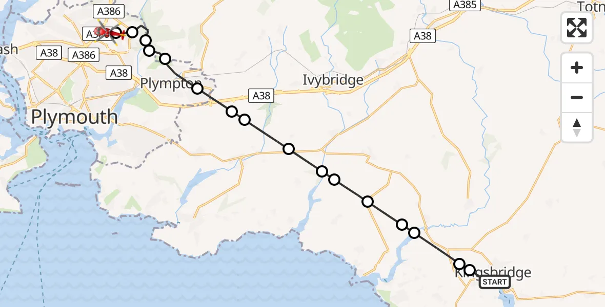
On Saturday, 18 April 2026 at 14:34, a Air Ambulance Helicopter departed from Kingsbridge to Estover. It was the Air Ambulance Helicopter with registration number G-CNLL. The flight lasted 10 minutes. During that period, the aircraft travelled 18 miles at an average speed of 109 miles per hour at a maximum altitude of 2125 feet.

Helicopter: G-CNLL
The helicopter G-CNLL is used as a air ambulance helicopter. The main purpose of this aircraft is to transport a Mobile Medical Team to an incident as quickly as possible, enabling the trauma doctor to provide immediate first aid on site. The aircraft is flying this flight as Air Ambulance Helicopter.
Photo: Tony Melony
19 miles
2125 feet
109 mph
11 minutes
14:34
14:44

Route
Research Way, Plymouth14:44
Estover, Plymouth14:43
Plympton, Plymouth14:43
Sparkwell, Devon14:42
Plympton, Plymouth14:42
Colebrook Village, Devon14:41
Colebrook Village, Plymouth14:40
Sparkwell, Devon14:40
Yealmpton, Devon14:39
South Hams, Devon14:38
Holbeton, Devon14:38
South Hams, Devon14:37
Kingston, Devon14:37
Bigbury, Devon14:36
Avon Estuary14:36
Churchstow, Devon14:35
A381, Devon14:34
Kingsbridge, Devon14:34
Live flights
Today
Flights Estover
Police Helicopter to Estover, Brest Road3 Jun 15:35
Air Ambulance Helicopter to Estover, Miller Way30 May 10:12
Air Ambulance Helicopter to Estover, Marjon Hill22 May 15:16
Air Ambulance Helicopter to Estover, Marjon Hill19 Apr 15:26
Air Ambulance Helicopter to Estover, Miller Way18 Apr 13:12
Flights Kingsbridge
Air Ambulance Helicopter to Kingsbridge18 Apr 13:47
Air Ambulance Helicopter to Derriford Hospital13 Jan 20:47
Helicopter flights on your website?
You can easily display helicopter flights on your own website. Use the embed code.
