Air Ambulance Helicopter to Derriford Hospital
Tuesday, 13 January 2026 | 20:47 | From Kingsbridge
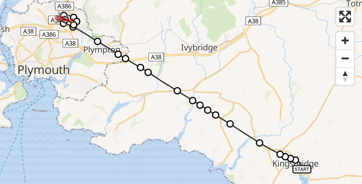
On Tuesday, 13 January 2026 at 20:47, a Air Ambulance Helicopter departed from Kingsbridge to Derriford Hospital. It was the Air Ambulance Helicopter with registration number G-DAAS. The flight lasted 16 minutes. During that period, the aircraft travelled 21 miles at an average speed of 77 miles per hour at a maximum altitude of 1975 feet.
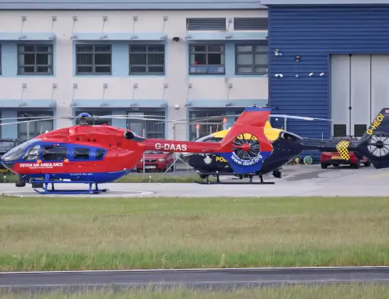
Helicopter: G-DAAS
The helicopter G-DAAS is used as a air ambulance helicopter. The main purpose of this aircraft is to transport a Mobile Medical Team to an incident as quickly as possible, enabling the trauma doctor to provide immediate first aid on site. The aircraft is flying this flight as Air Ambulance Helicopter.
Photo: Alan Wilson
21 miles
1975 feet
77 mph
17 minutes
20:47
21:04

Route
Derriford Hospital, Plymouth21:04
Derriford Hospital, Plymouth21:03
Plymouth21:02
Plympton, Plymouth21:01
Plymouth21:01
Plymouth City Airport, Plymouth, Devon21:01
Crownhill, Plymouth21:00
Plymouth20:59
Plympton, Plymouth20:58
Colebrook Village, Plymouth20:58
Sparkwell, Plymouth20:57
Sparkwell, South Hams20:57
Yealmpton, South Hams20:57
South Hams, Devon and Torbay20:56
Holbeton, South Hams20:55
South Hams, Devon and Torbay20:55
Kingston, South Hams20:55
Modbury, South Hams20:54
Bigbury, South Hams20:54
Aveton Gifford, South Hams20:53
Churchstow, South Hams20:52
West Alvington, South Hams20:52
Churchstow, Kingsbridge20:52
West Alvington, Kingsbridge20:51
High House Lane, South Hams20:51
Kingsbridge, South Hams20:47
Live flights
Police Helicopter on its way from Ewelme13 Jul 22:24
Today
Police Helicopter to Bournemouth Airport13 Jul 23:55
Air Ambulance Helicopter to Cardiff Heliport13 Jul 23:38
Police Helicopter to Birmingham Airport13 Jul 23:21
Police Helicopter to Irlam, Twelve Yards Road13 Jul 23:00
Flights Kingsbridge
Air Ambulance Helicopter to Kingsbridge18 Apr 13:47
Air Ambulance Helicopter to Derriford Hospital13 Jan 20:47
Helicopter flights on your website?
You can easily display helicopter flights on your own website. Use the embed code.
