Air Ambulance Helicopter to Earls Colne Airfield
Wednesday, 15 April 2026 | 18:06 | From Harwich
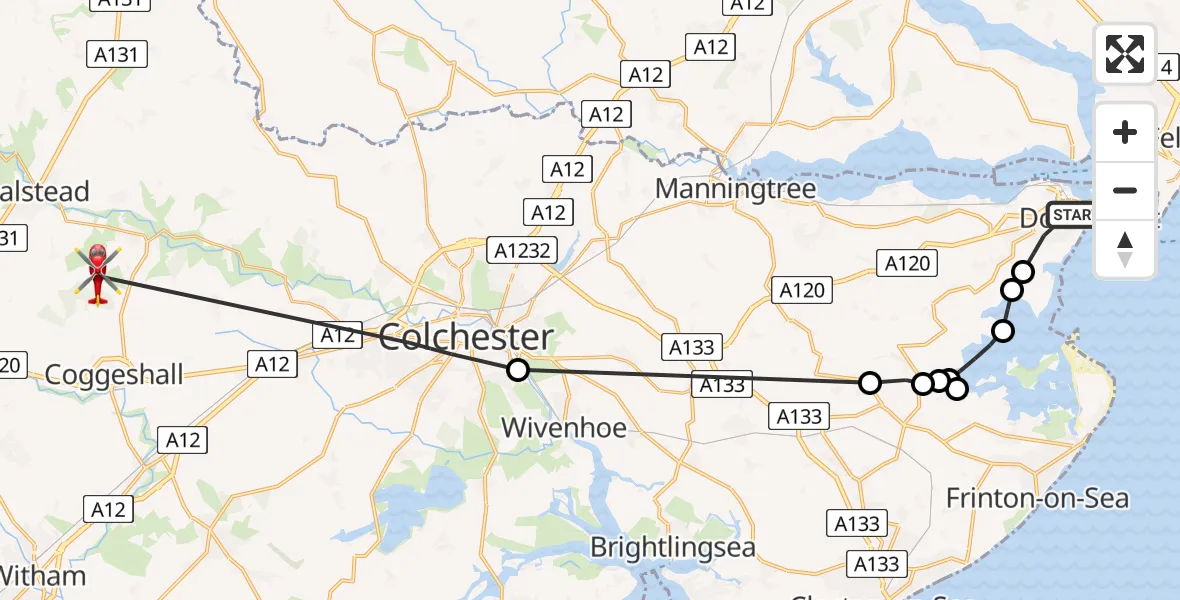
On Wednesday, 15 April 2026 at 18:06, a Air Ambulance Helicopter departed from Harwich to Earls Colne Airfield. It was the Air Ambulance Helicopter with registration number G-EHAT. The flight lasted 20 minutes. During that period, the aircraft travelled 29 miles at an average speed of 88 miles per hour at a maximum altitude of 1075 feet.
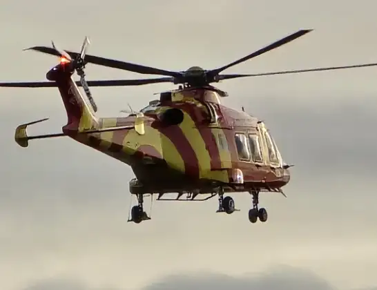
Helicopter: G-EHAT
The helicopter G-EHAT is used as a air ambulance helicopter. The main purpose of this aircraft is to transport a Mobile Medical Team to an incident as quickly as possible, enabling the trauma doctor to provide immediate first aid on site. The aircraft is flying this flight as Air Ambulance Helicopter.
Photo: By Steve Knight
30 miles
1075 feet
88 mph
21 minutes
18:06
18:26

Route
Earls Colne Airfield, Colchester, Essex18:26
Colchester, Essex18:20
Thorpe-le-Soken, Essex18:14
Beaumont-cum-Moze, Essex18:13
Landermere, Essex18:13
Beaumont-cum-Moze, Essex18:12
Landermere, Essex18:12
Beaumont-cum-Moze, Essex18:11
Little Oakley, Essex18:10
Tendring, Essex18:10
Fronks Road, Essex18:09
Harwich, Essex18:06
Live flights
Today
Air Ambulance Helicopter to Inner Seas15 Apr 22:16
Police Helicopter to Harborough, Sulby Road15 Apr 22:11
Police Helicopter to Bournemouth Airport15 Apr 22:01
Police Helicopter to Blaby, Great Central Way15 Apr 21:58
Coastguard Helicopter to Humberside Airport15 Apr 21:56
Police Helicopter to Almondsbury Helicopter Base15 Apr 21:56
Police Helicopter to Woolsington15 Apr 21:53
Air Ambulance Helicopter to Treliske Hospital15 Apr 21:42
Flights Harwich
Air Ambulance Helicopter to Earls Colne Airfield15 Apr 18:06
Helicopter flights on your website?
You can easily display helicopter flights on your own website. Use the embed code.
