Police Helicopter to Dunstable, Whipsnade Road
Wednesday, 15 April 2026 | 14:45 | From Dunstable
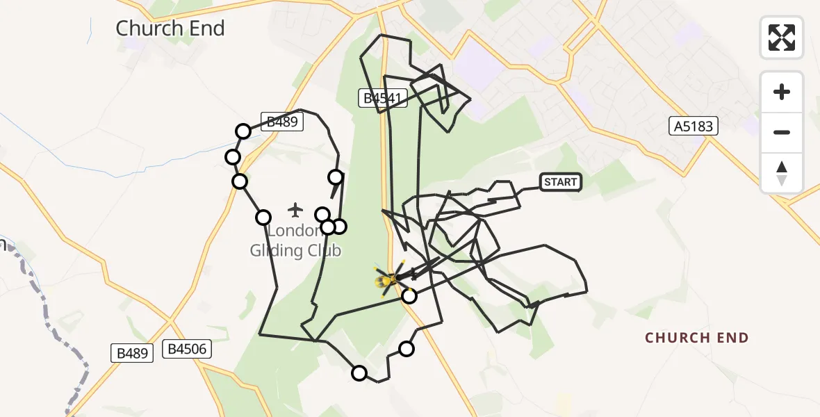
On Wednesday, 15 April 2026 at 14:45, a Police Helicopter departed from Dunstable to Dunstable. It was the Police Helicopter with registration number G-POLF. The flight lasted 37 minutes. During that period, the aircraft travelled 17 miles at an average speed of 29 miles per hour at a maximum altitude of 1400 feet.
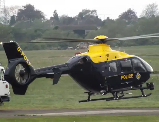
Helicopter: G-POLF
The helicopter G-POLF is used by the British police. The helicopter is deployed in pursuits, missing persons cases and other incidents where a helicopter provides added value.
Photo: James
18 miles
1400 feet
29 mph
38 minutes
14:45
15:22

Route
Whipsnade Road, Central Bedfordshire15:22
Dunstable, Central Bedfordshire15:18
Eaton Bray, Central Bedfordshire15:15
London Gliding Club, Dunstable15:15
Eaton Bray, Central Bedfordshire15:15
London Gliding Club, Dunstable15:14
Dunstable, Central Bedfordshire15:12
Church End, Central Bedfordshire15:12
Dunstable, Central Bedfordshire15:12
London Gliding Club, Dunstable15:11
Eaton Bray, Central Bedfordshire15:10
Kensworth, Central Bedfordshire15:09
Knotts Close, Central Bedfordshire14:45
Today
Police Helicopter to Falkirk02:12:08
Flights Dunstable
Air Ambulance Helicopter to Papworth Hospital28 Jun 18:16
Police Helicopter to Dunstable, Whipsnade Road15 Apr 14:45
Police Helicopter to Dunstable, Knotts Close15 Apr 13:44
Air Ambulance Helicopter to North Weald Airfield25 Mar 16:33
Police Helicopter to Welwyn Hatfield12 Jan 12:13
Helicopter flights on your website?
You can easily display helicopter flights on your own website. Use the embed code.
